
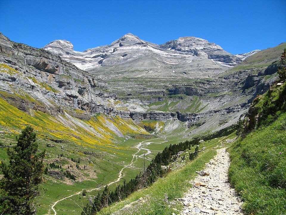
A summit "lost" behind the cirques
Seen from France, the mass of Monte Perdido disappears behind what field reports describe as the "seemingly impenetrable" peaks of the cirques of Gavarnie and Estaubé. This invisibility from the northern slope partly explains the reputation for isolation that surrounds the summit and gave it its name — Mont Perdu in French, a direct translation of the Spanish Monte Perdido. The summit reaches 3,355 m, the established altitude for the highest point of the massif of the same name.
Geography and protected setting
Monte Perdido lies in the western part of the Pyrenees, to the north of the province of Huesca, in Aragon. It forms the highest point of the Monte Perdido massif and falls within the boundaries of the Ordesa y Monte Perdido National Park. This dual status — belonging to a massif that bears its name and to one of the oldest national parks in Spain — underlines the structuring role this summit plays in Pyrenean geography.
The third-highest summit of the Pyrenean chain, Monte Perdido ranks behind Aneto and Posets. Its Aragonese anchorage, combined with its geographical position on the border between the French and Spanish slopes, makes it an indispensable point of reference for understanding the relief of the central Pyrenees.
Names and dual identity
The summit answers to both names — Mont Perdu on the French side, Monte Perdido on the Spanish — a reflection of the cross-border position of the Pyrenean massif. This nominal duality, far from being incidental, expresses the shared history of the two slopes and the way in which each culture named a summit it could only see obliquely, hidden behind the great walls of the glacial cirques.