
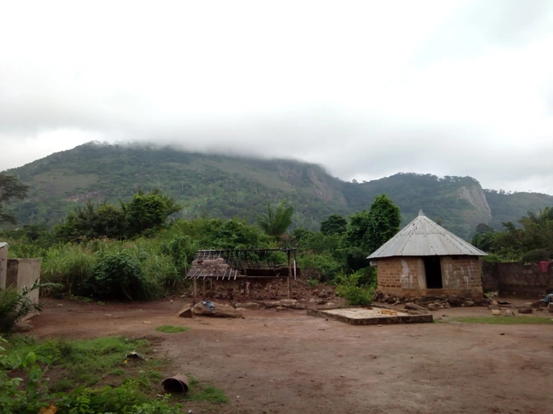
Terrain and landscape
The park brings together granite domes, waterfalls, and remnants of primary forest. In Cyrille Bah's photograph, taken in July 2017, the forest rises all the way to the rock faces. The upper part of the massif disappears into cloud.
The establishment of the park in 1968
The decree of 9 February 1968 creates a park of approximately 34,000 hectares. Its boundary follows watercourses and old tracks among other features. The text assigns scientific and educational objectives to the protection of wildlife and vegetation.
Changes in forest cover
A study published in 2020 compared four Landsat images taken in 1988, 2002, 2011, and 2016. Within the study area, which covered approximately 302 km², forest extent fell from 286.23 to 92.32 km². The authors observed an acceleration in deforestation during the conflicts of 2002 to 2011, and again between 2011 and 2016. They link this to the expansion of cocoa plantations.
Wildlife and conservation mapping
A survey published in 2022 combined interviews with local residents and park managers with on-foot prospecting. The researchers confirmed the presence of the western chimpanzee (Pan troglodytes verus) through direct sightings or signs of presence. The Ivorian Office of Parks and Reserves also records the forest elephant.
In 2024, a new map was validated by local stakeholders, according to the Agence ivoirienne de presse. It describes land use within the park and in its surroundings to inform conservation decisions.