
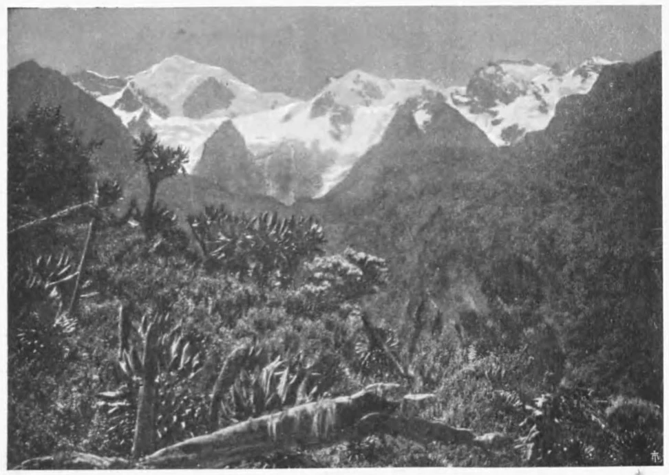
A Photograph and a Shrinking Ice Front
In 1891, German naturalist Franz Stuhlmann photographed Mount Stanley from the Butagu Valley on the western side of the range. That image was later printed in Filippo De Filippi's 1908 expedition account and became a reference point for subsequent observers of the mountain's glaciated terrain. When Belgian glaciologist Jean de Heinzelin carried out field observations in July 1950, he drew on dated photographs to reconstruct change on the Congo slope. His 1952 paper places the tongue of the West Stanley Glacier near Lac Gris in 1932. In 1950, he found bare rock and debris above the lake, with the glacier ending halfway down the slope. Higher up, Lac Blanc had appeared between 1935 and 1939, occupying ground that ice had formerly covered. Heinzelin’s figures describe the West Stanley Glacier, south of the Alexandra Glacier.
The 1956 Direct West-Face Route
The American Alpine Journal records that on 25 March 1956, Piero Ghiglione led the first direct ascent of the west face of Margherita Peak, a party of four in total. Ghiglione's own account in the Swiss Alpine Club journal describes four days of travel through the western forest before the team established a camp on a moraine saddle at roughly 4,500 metres. Guide Ernesto Frachey cut steps through a steep ice funnel on the direct west face after the party crossed a bergschrund to gain the upper wall. A 1932 expedition had taken an earlier line from the Alexandra Glacier via the saddle between the Albert and Margherita summits.
Later Observations and the Range's Remaining Ice
In 2005, Mark Jenkins reported on a west-face route climbed with Steve Roach, descending the West Stanley Glacier from the plateau and crossing rock ravines before ascending the western wall. The broader trajectory of ice loss across the range was quantified in a 2024 satellite study, which inventoried the entire Rwenzori in 2021–2022 and recorded a total ice cover of 0.38 square kilometres for the whole range.