
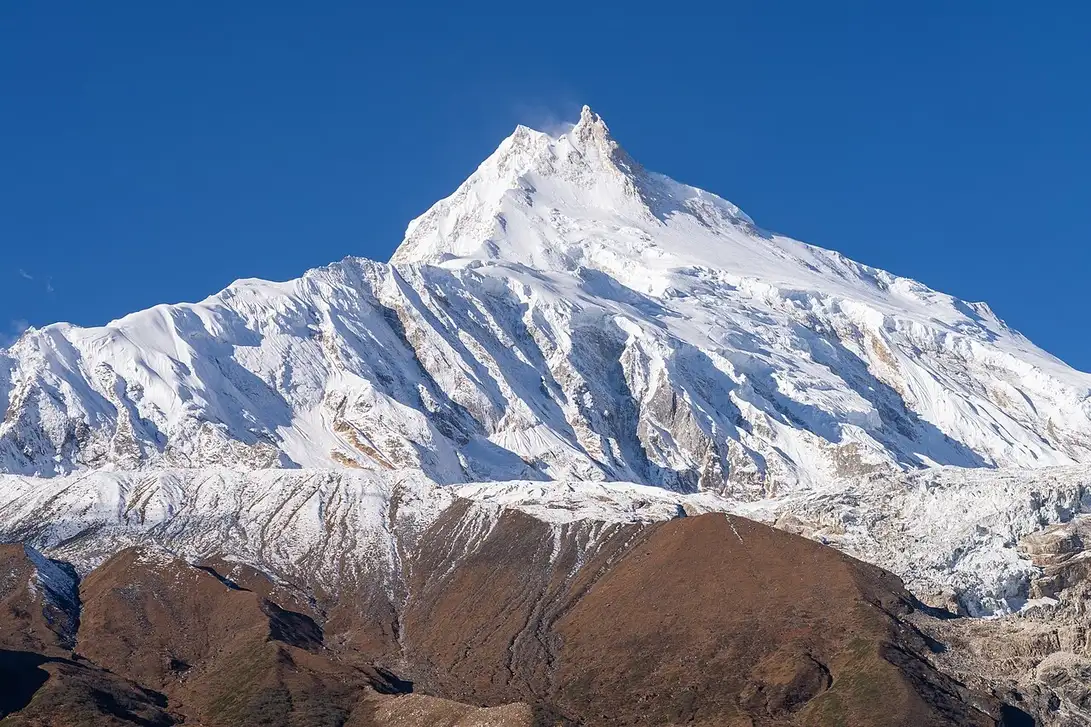
A Landscape Between Two Worlds
The geography surrounding Manaslu is defined by an unusually sharp ecological transition. At lower elevations, monsoon-influenced forest and agricultural land predominate, while the terrain above shifts into the high-plateau character of the trans-Himalayan zone — drier, more austere, and culturally distinct. This gradient runs through the northern Gorkha district, where settlements including Samagaun, Lho, Chumchet, and Chhekampar sit within the Tsumnubri Rural Municipality.
The Manaslu Conservation Area, declared on 28 December 1998, formalises the significance of this corridor. Covering 1,663 square kilometres, the area encompasses seven wards of the Tsumnubri Rural Municipality and was established with an explicit mandate to link conservation objectives with the livelihoods of local communities. The conservation boundary is distinct from the mountain's immediate slopes and reflects a regional rather than summit-focused vision of stewardship.
The 1956 First Ascent and Japanese Himalayan Mountaineering
The first ascent of Manaslu was an expedition achievement led by Yuko Maki. The team established six camps on the mountain, with the final high camp positioned at approximately 7,800 metres. From Camp VI on the morning of 9 May 1956, Toshio Imanishi and Gyalzen Norbu departed for the summit, reaching the top at around 12:30 in the afternoon. Two days later, Kiichiro Kato and Minoru Higeta repeated the ascent, confirming the route and extending the expedition's record.
Gyalzen Norbu's role in the first ascent carried particular historical weight. The Himalayan Journal records that he had reached the summit of Makalu the previous year, making him the first climber to have summited two 8,000-metre peaks. Imanishi and Norbu's success on Manaslu also represented a milestone for Japanese mountaineering more broadly — a tradition that had developed through the prewar and wartime decades and emerged with significant Himalayan ambitions in the 1950s, as documented in the Himalayan Journal's account of Japanese climbing before and after World War II.
Earlier Attempts and the Village of Sama
Before the 1956 success, Japanese expeditions made multiple attempts on Manaslu during the early 1950s. The American Alpine Journal's contemporary account of the 1956 expedition notes that during the 1954 attempt, villagers at Sama acted to prevent the climbing party from proceeding. The journal's report presents this as a form of local resistance; the precise motivations behind it are not fully detailed in available sources and should not be characterised beyond what the record establishes.
The varying ways in which sources count earlier reconnaissance and summit bids makes a definitive tally of prior attempts difficult to establish. What is clear is that sustained Japanese engagement with the mountain across several seasons preceded the 1956 success, and that the relationship between the climbing parties and communities in the Manaslu region was not straightforward during those years. The settlement of Samagaun — today within the Manaslu Conservation Area — sits at the centre of that history.
Conservation and Community in the Northern Gorkha District
The Manaslu Conservation Area Project, administered by the National Trust for Nature Conservation, operates across the 1,663-square-kilometre protected zone in a region that includes both the ecological transition described above and a culturally layered highland community. The seven wards of Tsumnubri Rural Municipality named in the project — including Samagaun, Lho, Chumchet, and Chhekampar — represent communities whose land use, pastoral practices, and local economies are directly engaged by the conservation framework.
The area's design reflects a philosophy that conservation in a high-altitude Himalayan zone cannot be separated from the people who inhabit it. The boundary of the conservation area, extending well beyond the peak itself, acknowledges that Manaslu as a geographical and cultural entity encompasses far more than a summit and its approaches. It includes the pasture corridors, village clusters, and transition landscapes that give the broader massif its distinctive character.