
Terrain and Setting
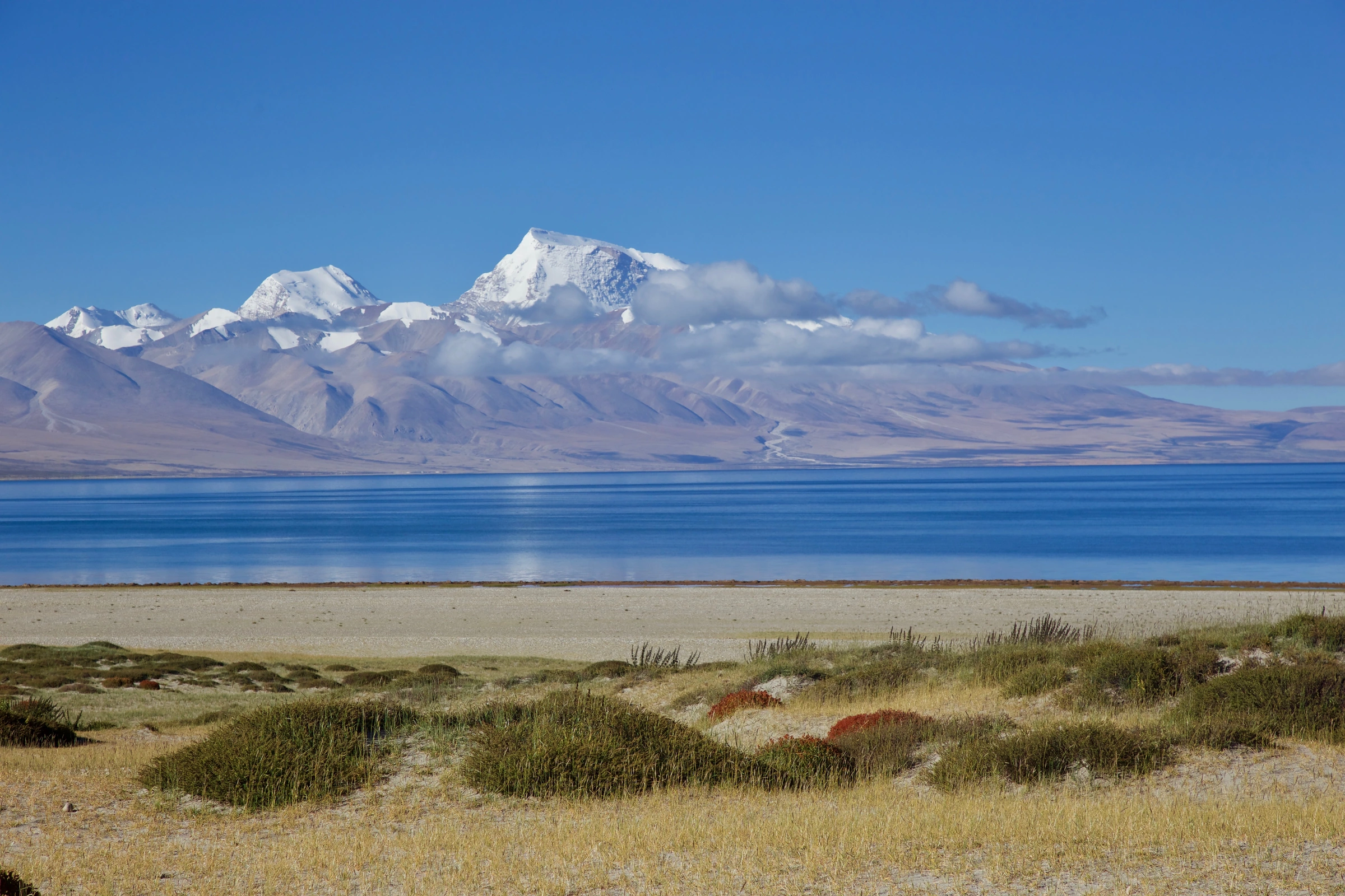
A nineteenth-century geographical account compiled by E. T. Atkinson in 1882 described the eastern flank of Manasarovar as carrying lower hills along its northern half and taller mountains along its southern half. The lake itself occupies a fault-bounded depression recorded in the Chinese Academy of Sciences gazetteer, with the Gangdise (Transhimalaya) range running to the north and the main Himalayan chain closing the horizon to the south. Looking southwest across the water, the snowy massif of Gurla Mandhata (Naimonanyi) is visible from the eastern shore, as a photograph taken near Seralung Gompa on 19 September 2016 by Jean-Marie Hullot illustrates: a grassy foreground, the lake, and the glacier-streaked face of Gurla Mandhata beyond.
Seralung Gompa and the Circumambulation Route
The principal monastic site on this shore is Seralung Gompa — also rendered Sewa Lung in China's 2017 UNESCO Tentative List submission for the Sacred Mountains and Lakes of Tibet. Burang County records place the monastery on a raised site close to the lake edge. Swami Pranavananda's 1949 book Kailas-Manasarovar maps the monastery as Seralung and identifies devotional structures distributed along the lake's circuit; his earlier 1939 work Exploration in Tibet records observations of freezing and thawing on Manasarovar and the neighbouring lake Rakshastal (La'ang Co) to the west. The lakeshore circuit has long functioned as a pilgrimage route, and the sites along it are places of spiritual practice.
Water Chemistry and the Wetland System
Yao Zhijun and colleagues published a 2015 study drawing on 43 shore and inflow samples collected during two field campaigns — 18 lake samples and 25 inflow samples taken in early August 2005 and late July 2012. Their analysis found that carbonate rock weathering is a principal contributor to the dissolved mineral load, while evaporation progressively concentrates solutes in the lake water. The researchers found that water chemistry varied more on the eastern than on the western shore. They recorded higher solute concentrations along the northern shore. Mountain snow and ice melt, groundwater, and rainfall all feed the wetland system, which includes marshy meadow and both perennial and seasonal water bodies.
Freshwater Manasarovar and the saltier Rakshastal to its west are treated as distinct lakes within the wider protected area. A national nature reserve covers the site, mapped by China's Ministry of Ecology and Environment, and Manasarovar was included in the Tibet Autonomous Region's first regional list of important wetlands in 2021. The National Forestry and Grassland Administration notes that the wetland supports black-necked cranes (Grus nigricollis) among its wildlife.