
Landform and River System
The Pangani Basin Water Board and IUCN distinguish two adjoining reaches: the mature lower river and its tidal estuary. Archaeologist Jonathan Walz, in his University of Florida dissertation, proposes that Pleistocene floods deposited cobbles across this terrain; subsequent erosion exposed concentrations of them on certain hill crests near the bay. His fieldwork found evidence that hunter-gatherers gathered exposed quartz cobbles for tool-making, suggesting the hills were resource sites long before any agricultural use.
Early Trade and Settlement
The lower Pangani and its bay sat within Indian Ocean trade networks by the later medieval period. Walz's archaeological record places Swahili settlements and coral construction in the bay area across the fourteenth and fifteenth centuries, linking them to the coastal exchange systems that connected this stretch of the Tanzanian littoral to wider regional commerce. Walz proposes that by around 1500 the river channel had shifted southward, away from the large trading settlement of Muhembo.
Sisal Introduction and Kikogwe
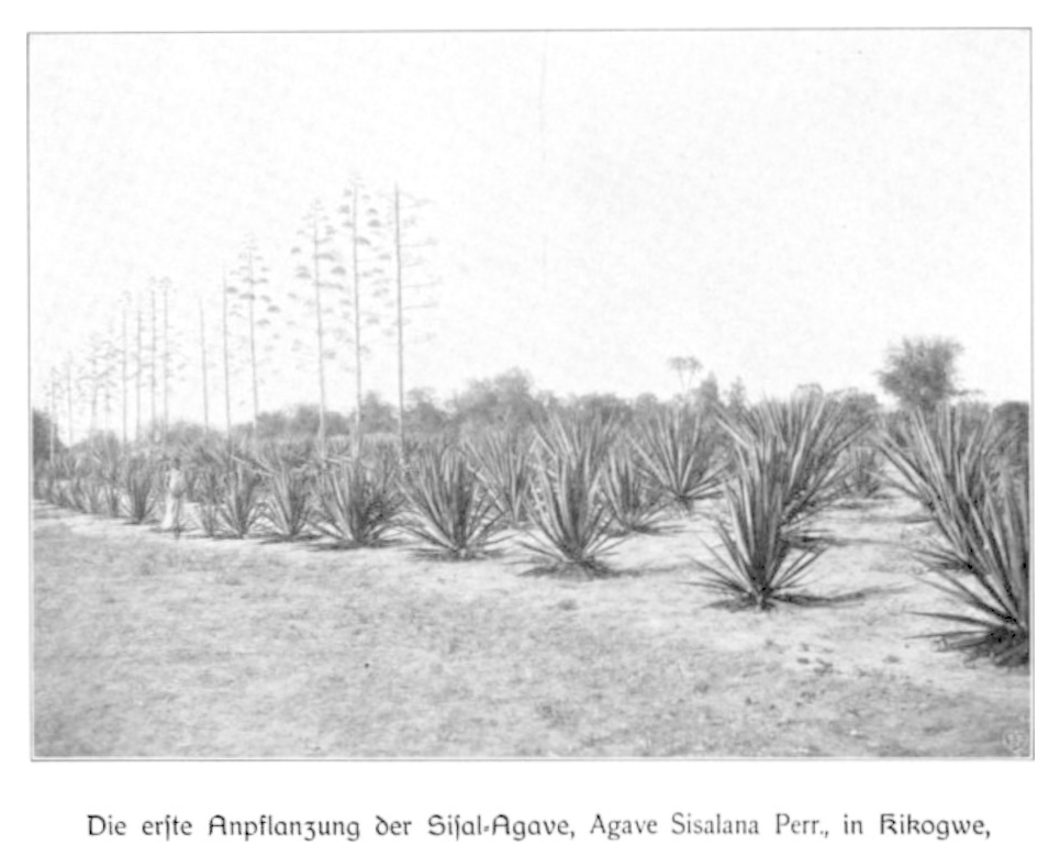
According to a 1944 letter by geneticist L. R. Doughty — citing agronomist Richard Hindorf's 1925 account — sisal was introduced to this area in 1893, with only 62 plants recovered from initial bulbils. The first nursery was established at Kikogwe, on the south side of the Pangani River. German Federal Archives hold plantation correspondence from Kikogwe dated 1895 to 1897, documenting early estate operations. By 1898, Doughty records 600 kilograms of fibre entering the broader export trade.
Across the river, the land was turned into the Bushirihof plantation complex; a University of Nairobi thesis records more than one million plants established there by 1903. Wohltmann's 1904 plate 87 — catalogued by Frankfurt University Library as his work — shows the young rows at Kikogwe on the south bank. Hanan Sabea's archival and field research on the Tanga sisal estates documents land claims and efforts to recruit migrant workers during this period, noting that workers moved between estates and smallholder farming rather than remaining fixed to a single property.
Water Quality and Agricultural Legacy
A 2007 survey by the Pangani Basin Water Board and IUCN measured water quality across the river and estuary. The survey documented agricultural runoff among multiple sources of impairment, including discharges associated with sisal plantations, and recorded exceptionally low dissolved oxygen at certain upper estuary sites.