
Landform and Local Identity
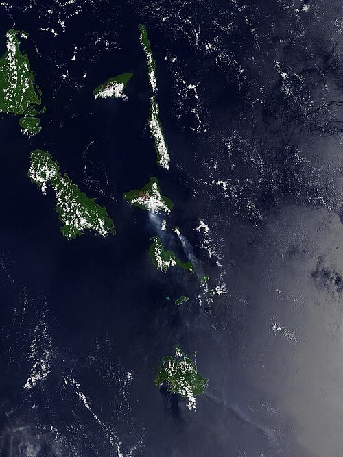
Lopevi is known in local tradition as Vanei Vollohulu, a name distinct from the internationally used designation. The island's form is defined by its steepness: rising from the sea across a diameter of approximately seven kilometres, it offers little low-gradient terrain, with the flanks dropping sharply toward the coast in most directions. At the summit, structural geology reflects the volcano's compound history—a newer, smaller cone nested within a crater that in turn crowns the main older edifice, a configuration that the Smithsonian Global Volcanism Program identifies as characteristic of the volcano.
A northwest–southeast fissure system runs across the flanks and has served as the principal conduit for lateral eruptions throughout recorded history. This fissure alignment has directed lava flows toward the coast on multiple occasions, shaping the island's irregular shoreline and connecting summit activity to dramatic changes at sea level.
The 1960 Eruption and Coastal Change
The eruption of 1960 stands as the most geomorphologically consequential documented event in Lopevi's modern history. Lava flows generated during this episode reached the western coast and built a new peninsula, permanently extending the island's landmass into the sea. The same eruption produced a pyroclastic flow that also reached the coastline. The Smithsonian Global Volcanism Program associates the 1960 eruption, together with a large eruption in 1939, with evacuations of the island's residents—placing the reshaping of the coast and the displacement of its population within the same dated historical sequence.
Eruptive History and Volcanic Structure
The Smithsonian associates major eruptions in 1939 and 1960 with evacuations. The 1960 eruption produced both a pyroclastic flow that travelled to the sea and a lava flow that extended the western shoreline. Those records link the residents’ displacement to a physical change visible on the island.