
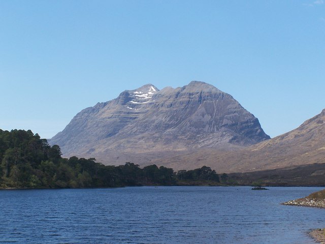
Summit and Ridge Geography
The mountain's highest point is Spidean a' Choire Lèith, a Munro standing at 1,055 metres (3,461 ft). A second Munro, Mullach an Rathain, reaches 1,024 metres (3,360 ft) at the western end of the main ridge. Between these two summits lies Am Fasarinen — 'The Teeth' — a succession of rocky pinnacles that reaches a height of 927 metres at its western end and is listed in the Munro Tables as a Munro Top. The ridge runs broadly east–west, and its predominantly pinnacled character means that there are few opportunities for descent once a traverse is under way, leaving walkers committed to completing the full route.
Liathach holds four listed Tops in the Munro Tables in total. Among them, Meall Dearg at 955 metres (3,133 ft) stands off the main ridge at the terminus of the Northern Pinnacles, which run northward from Mullach an Rathain. The route along those Northern Pinnacles is classified as a rock climb. An alternative line to Meall Dearg via Coire na Caime reduces the technical demand considerably, requiring only a short steep scramble over the final 50 metres to gain the ridge.
Terrain and Character
The mountain's upper half is built from many layers of steep rocky terraces, a structure that gives Liathach its distinctive tiered appearance when viewed from Loch Clair to the south-east. This terraced geology is characteristic of the Torridon sandstone that underlies much of the Northwest Highlands, and it contributes directly to the sustained technical nature of the ridge. Am Fasarinen in particular is widely regarded as the defining passage of the traverse: the pinnacles demand careful route-finding and, for walkers who do not opt to bypass them on paths below the crest, a degree of scrambling competence.
The mountain's position between Loch Torridon to the south and Beinn Eighe to the east places it at the heart of a landscape shaped by ancient geology and deep glacial carving. The long, unbroken western flank and the coire systems cut into the northern face together reinforce the sense of a mountain that presents steep ground in almost every direction.
Name and Identity
The name Liathach carries a linguistic distinction worth noting: standard Scottish Gaelic renders it as Liathach [ˈʎiəhəx], meaning 'the hoary place' — a reference to the pale, grey-toned quartzite that caps its summits and gives the mountain its characteristic bleached appearance in certain lights. The local Torridon Gaelic dialect preserves an older or regionally distinct form, Liaghaich [ˈʎiəɣɪç], pointing to a living tradition of place-naming that pre-dates the standardised orthography used in modern Munro Tables and mapping.