
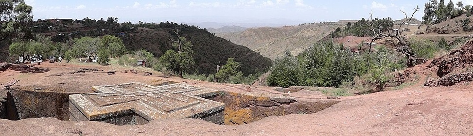
Scoriaceous Basalt of the Palaeovalley
The hill consists of scoriaceous basalt deposited in an east-west palaeovalley, with an upper porous volcanic layer overlying denser, less permeable basalt beneath. Pre-existing cooling joints and weathering planes within this formation were documented during field geotechnical surveys published in the Journal of African Earth Sciences, available via DOI issued in 2010.
Eleven Churches and the UNESCO Inscription of 1978
The eleven rock-hewn churches carry a traditional attribution to King Lalibela and were inscribed on the UNESCO World Heritage List in 1978. Among them, Bete Giyorgis stands as a cross-shaped monolith cut entirely free from the surrounding rock, while Bete Medhane Alem and the churches grouped around it represent a separate cluster linked by carved trenches.
Water Infiltration Documented at Bete Merqorios and Bete Aba Libanos
Geotechnical fieldwork recorded in the 2011 issue of the Journal of African Earth Sciences identified water infiltration and cracking specifically at Bete Merqorios and Bete Aba Libanos. The University of Toronto's Ethiopic Churches project has conducted contemporary rock-hewing research in North Wollo, contributing further field data on the structural condition of the church complex.