
Anatomy of a Fissure System
Krafla belongs to the Northern Volcanic Zone, the onshore expression of the Mid-Atlantic Ridge where the North American and Eurasian plates continue to pull apart. The fissure corridor associated with Krafla runs roughly 100 kilometres through northern Iceland, and eruptions along it can originate far from the summit area. The highest ground reaches around 800 metres, with the caldera rim and its interior lava fields spreading across a wide plateau rather than converging on a single peak.
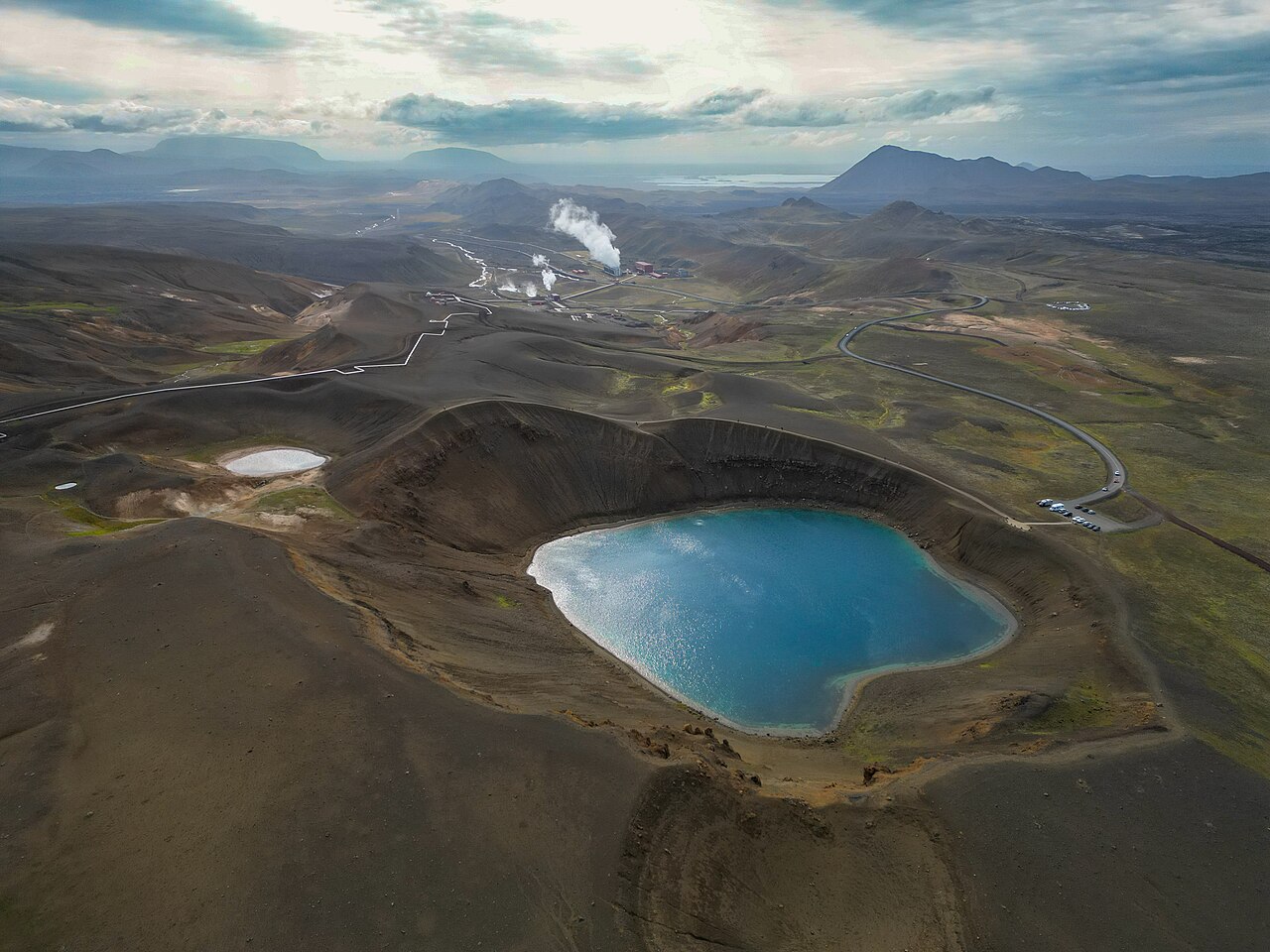
Within the caldera sits Víti, a crater whose name translates as Hell in Icelandic. This feature formed in 1724 at the outset of what became known as the Mývatn Fires, an extended eruptive episode geographically associated with the Krafla system.
The Krafla Fires, 1975 to 1984
Between 1975 and 1984, Krafla experienced a sequence of rifting episodes and fissure eruptions known collectively as the Krafla Fires. The sequence involved repeated cycles in which magma migrated laterally from the central volcano into the surrounding fissure system, causing the ground to inflate and deflate before erupting. Nine basaltic fissure eruptions occurred over this period, and the Icelandic Museum of Natural History records the total lava output at around 0.25 cubic kilometres.
Geothermal Character and Scientific Study
The heat source that drives Krafla's volcanism also brought the area into the orbit of applied earth science. Research published in the Icelandic glaciological journal Jökull documented the exploration and development of the Krafla geothermal area, describing how subsurface heat resources were investigated and put to local use. This work proceeded in parallel with the ongoing eruptive activity of the Krafla Fires, making Krafla a case study in which resource development and active volcanism intersected directly.
Mývatn and the Regional Setting
Lake Mývatn lies to the southwest of Krafla and provides the primary geographical anchor for the volcanic system within Iceland's broader landscape. The 1724 Mývatn Fires, which opened the Víti crater within the Krafla system, marked the beginning of a documented record of eruptive unrest in this corner of northern Iceland.
The scale of the Krafla system — caldera, fissure corridor, and geothermal field considered together — means that understanding it requires thinking in terms of a volcanic landscape rather than a single summit. The approximately 800-metre high point offers elevation and perspective, and the defining character of Krafla lies in the lateral spread of a fissure system across the northern Icelandic plateau.