
Ridge, creek, and the shape of travel
The Kokoda Track Authority’s route begins at Owers’ Corner and crosses Imita and Ioribaiwa ridges. It climbs through Efogi, where the authority lists two camps at about 1,220 and 1,350 metres, and crosses a high ridge near Mount Bellamy. Past Templeton’s Crossing and the Eora Creek valley, the trail descends through Isurava and reaches Kokoda at about 350 metres. Repeated climbs from creeks to the narrow ridges shaped how people and goods moved through the range.
Papua New Guinea’s report to the Convention on Biological Diversity records the route’s use by Papuan communities before the fighting. The country’s nomination also records endemic wildlife and plants across the wider Owen Stanley Ranges, including species confined to the mountains of eastern New Guinea.
Contested ground, 1942
The Kokoda campaign lasted from July to November 1942. In September, Japanese forces advancing towards Port Moresby held Ioribaiwa Ridge. Australian forces took up positions further south at Imita Ridge. An Australian military sketch map of the Efogi–Kokoda area shaded dense forest in green, recording the terrain that infantry and their Papuan allies had to cross.
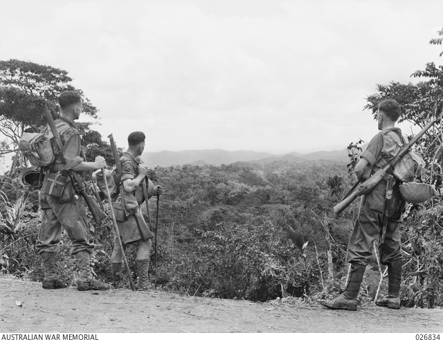
Papuan guides helped troops find their way, while carriers brought supplies to the front and walked wounded men back along the track. Australian forces eventually returned to Kokoda in November. A month earlier, Thomas Fisher photographed three Australian soldiers on Ioribaiwa Ridge looking back towards Kokoda. The wooded ridges fill the space between the three figures in the Australian War Memorial’s print (026834).
Conservation and binational recognition
Papua New Guinea placed the Kokoda Track and Owen Stanley Ranges on UNESCO’s Tentative List in June 2006. In April 2008, Papua New Guinea and Australia signed an agreement to protect the corridor and support the people who live along it. Later that year a new health centre opened at Efogi, about halfway along the track.