
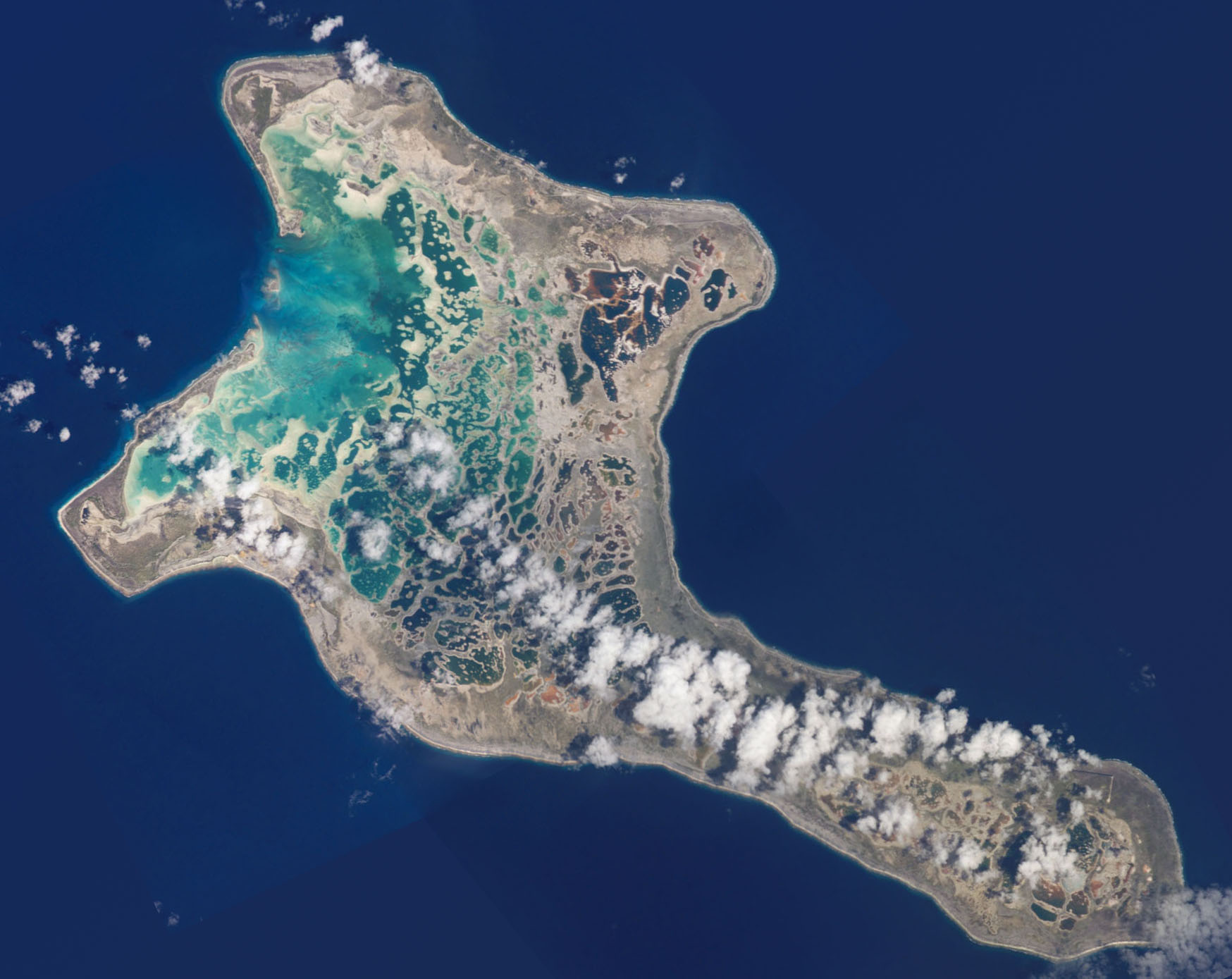
A Landscape Built in Layers
The atoll rests on a volcanic base overlain by a platform of coral limestone, with coastal ridges and dunes formed through the transport and accumulation of loose coral sand and rubble. At a measured plot near Cecidie Peninsula, east of the settlement of Poland, Morrison and Woodroffe's 2009 soil survey recorded land approximately 2.5 metres above sea level, covered in coral sand and gravel on the central ridge. Inland dunes across the atoll rise to roughly 5 metres in places, while Joe's Hill, in the southeast, reaches approximately 13 metres, making it the atoll's high point according to both the Kiribati cable project environmental report and the Morrison and Woodroffe survey. Drilling into some coastal sections has detected considerably older limestone beneath the surface formations.
An earlier lagoon
In the atoll interior, Woodroffe and McLean mapped branching corals preserved upright in their original growth positions, now surrounded by the network of smaller lakes and pools. Their survey interprets these formations as the remnants of an interconnected lagoon reef that flourished before local relative sea level fell in the late Holocene. Ryan and colleagues' 2021 fossil reef surveys found different ages of coral growth at different lagoon sites. The coast's present relief combines this older limestone with younger deposits of sand and coral rubble reshaped by wind and wave.
Coral stone and shell tools
A 1999 field survey published by Atholl Anderson and colleagues in 2000 documented archaeological evidence around Manulu Lagoon, including ovens and stone structures built from coral and slabs of hardened limestone, as well as worked shell recovered from separate dune locations. A limited set of radiocarbon dates from the Manulu site group suggests activity there between the thirteenth and fifteenth centuries.