
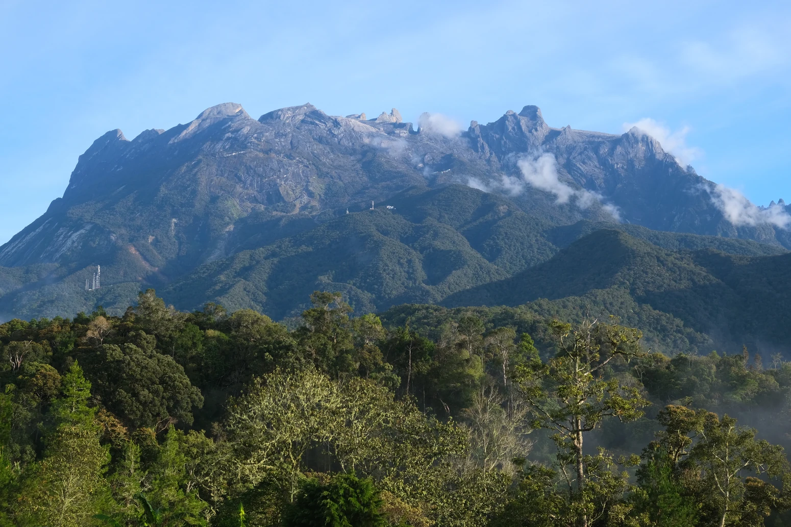
A Granite Intrusion Shaped by Deep Time
The mountain's uppermost terrain is the exposed face of a granite body that formed underground roughly 15 million years ago and was gradually elevated by tectonic movement. Between Laban Rata and Low's Peak, climbers enter the hornblende granite zone where the bedrock is bare and the scale of the intrusion becomes fully visible.
Below the summit massif, Low's Gully — the great chasm on the mountain's north face — records two distinct phases of landscape history. UNESCO's Global Geopark documentation attributes its initial carving to glacial erosion, with river action continuing the work in later epochs. The park's geological heritage is recognised under a separate UNESCO programme from its World Heritage status, which was inscribed in 2000 for the 75,370-hectare Kinabalu Park.
Forest Zones and the Cloud-Forest Belt
Kinabalu's vegetation changes character with altitude in a succession well documented by Sabah Parks. Lowland tropical forest gives way, at roughly 1,200 metres, to oak and conifer forest, before upper montane cloud forest takes over around 2,200 metres. In the cloud forest, mosses and liverworts cover the trees; orchids, rhododendrons, and conifers are also common at this elevation.
Above the forest, the exposed upper granite of the summit plateau creates an abrupt visual boundary between rock and tree line that is one of Kinabalu's defining features. The park's botanical diversity is substantial: UNESCO notes that at least half of Borneo's plant species are represented here, and Sabah Parks identifies Low's rhododendron as one of the notable species found in the cloud forest.
The 1851 Ascent and the People Behind It
The first documented ascent of the mountain was made in 1851 by Hugh Low, a British colonial administrator whose name was subsequently attached to both the summit peak and the Gully. Sabah Parks research recorded in its Nature Journal specifically identifies Lemaing of Kiau as the local guide who assisted Low during that expedition. The Hugh Low Trail, which begins at Kiau, preserves a direct topographic link to that historic route.
Sabah Parks' historical exhibits also recognise Dusun guide Gunting Lagadan, from Bundu Tuhan, as a significant figure in the mountain's climbing history — a distinct recognition from the account of the 1851 party. The present main ascent route is known as the Timpohon route, a name recorded by Sabah Parks alongside the official designation of Low's Peak as the registered summit.
World Heritage and Geopark Recognition
Kinabalu Park's UNESCO World Heritage inscription in 2000 acknowledged the mountain and its surrounding 75,370 hectares as an area of outstanding universal value for both natural heritage and biodiversity. The Kinabalu UNESCO Global Geopark designation operates as a parallel framework, with specific emphasis on geological heritage including the granite intrusion, Low's Gully, and the broader tectonic story legible in the landscape.
The two UNESCO designations reflect distinct aspects of Kinabalu's significance. The World Heritage listing recognises the mountain's natural processes and exceptional biodiversity, including its diverse plant communities. The Global Geopark designation describes geological heritage — among it the glacier and river erosion evident in Low's Gully — and encompasses work with local and Indigenous communities.