
Subsidiary volcanism and eroded cones
Kilimanjaro's main volcanic centres are accompanied by smaller satellite vents that built their own cones during successive eruptive phases. The Kibongoto cone is one such feature, catalogued by the Smithsonian Global Volcanism Program on Shira’s southern flank. A regional geological survey held at the JICA Library records multiple heavily eroded cones in the Kibongoto zone below approximately 7,000 feet (about 2,130 metres), although the survey did not resolve the relationship of those cones to the Shira lava flows or establish independent dates for them. Field expeditions in 1953 and 1957, carried out by researchers including Charles Downie and P. Wilkinson of the University of Sheffield and the Tanzania Geological Survey, produced the geological data that underpinned a 1972 regional synthesis.
The repeated cycles of eruption and subsequent weathering are legible in the terrain. Where younger eruptive material retains cone structure, erosion can reduce older cones to low, rounded hills difficult to distinguish from one another. The Kibongoto zone exemplifies this pattern: several formations cluster within a compact area, their original profiles substantially flattened, their stratigraphic relations to surrounding lava fields unresolved in that survey.
The Leipzig Mission and Mangi Ngalami
Documentary evidence places the establishment of a Leipzig Mission station at Kibongoto, also recorded as Kibognoto, in August 1899. The Tübingen–Moshi Wachagga Project, drawing on mission archives, records this date and identifies Ngalami as the leader of Kibongoto and Shira at the time. Surviving documentary evidence from this period includes a land contract naming Ngalami as chief of Kibonata and describing the Shira mission property, alongside contemporary sketches of the site.
On 2 March 1900, the German colonial administration publicly hanged Ngalami alongside Mangi Meli, Mangi Molelia, and other leaders in Moshi.
Landscape: forest, farmland, and the district road
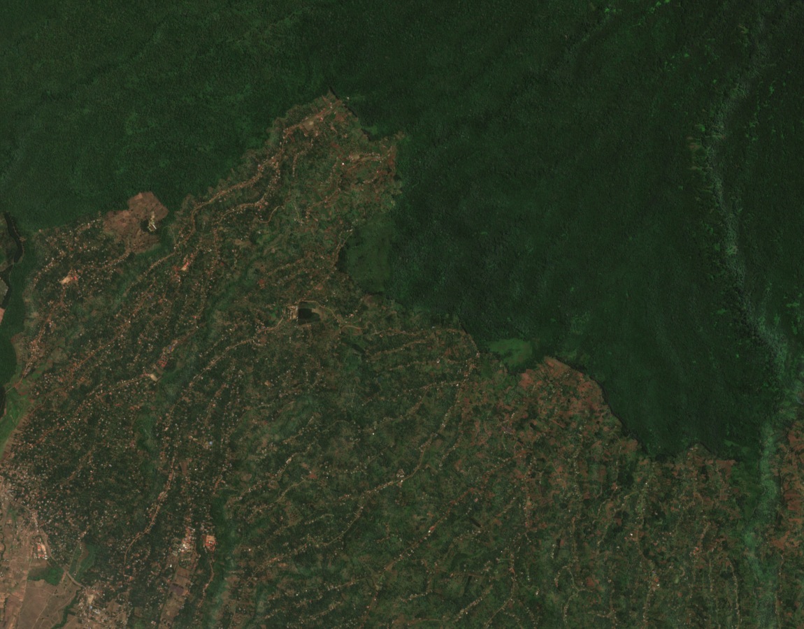
A Copernicus Sentinel-2 scene acquired on 6 September 2025 shows an approximately 11.5 by 9 kilometre area centred on the GVP-catalogued Kibongoto point. The northern portion of the image is dominated by dense montane forest, its canopy a continuous deep green across the lower volcanic slopes. To the south, the forest boundary gives way abruptly to a mosaic of cultivated fields and settlement lanes, the agricultural zone extending across the lower foothills toward Siha District's populated corridors.
The 2010 Africa Community Access Programme design survey of the Lawate–Kibongoto road documents this settled landscape in engineering terms, recording the route as an existing district road and surveying its gradients and longitudinal profiles.