
Summit Name and Location
The Chukyo Alpine Club's route table identifies Kiagar Ri as P6100, Open Peak no. 104, near 33°07′26″ N, 78°13′00″ E. The Copernicus DEM puts the ground elevation there at approximately 6,100 m.
Kiagar Tso lies to the east of the peak and Spangnak Ri lies farther to the west.
Expedition Record
On 26 June 2012 Raka Mandal and Puspal Kundu reached Kiagar Ri by the southwest ridge. They were part of an expedition led by Debabrata Mukherjee, who split from their group at a col to head toward Spangnak Ri and later reunited with them there. The Himalayan Club documents this ascent.
Jurgalski reports in the American Alpine Journal that on 27 June, Karl Herberger traversed Kiagar Ri solo from east to west before continuing onto the southeast ridge of Spangnak Ri.
Kiagar Tso
A survey supported by the Rufford Foundation recorded the lake's alternate name Thasangkaru Tso and described its water as brackish. Jamwal, Shrotriya and Takpa record its area at 5.48 square kilometres. Hedrick and colleagues describe a stream draining Kiagar Tso that joins the Puga River south of Sumdo.
A September to November 2013 field survey of Changthang Wildlife Sanctuary recorded five waterbird species at Thasangkaru Tso (Kiagar Tso): northern pintail, ruddy shelduck, common sandpiper, brown-headed gull and great crested grebe.
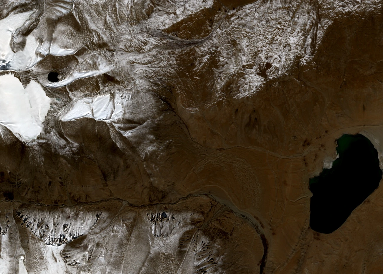
Summit and Lake in Satellite View
In the 15 October 2025 Sentinel-2 true-colour image, Kiagar Ri appears left of centre among snowy ridges. The dark surface of Kiagar Tso is visible to the right, to the east.