
A Volcano Named for a Sea Deity
According to the Smithsonian Global Volcanism Program, Kavachi takes its name from a sea deity of the Gatokae and Vangunu peoples. Eruptions have been documented at this location since at least 1939, establishing a long record of intermittent activity at the vent.
Temporary Islands and the Variable Reach of Eruptions
On multiple occasions, documented eruptions have driven material above the sea surface, forming temporary islands. Activity in 2002 produced a heat signal when volcanic matter breached the surface. Not every eruption builds an island; whether temporary land forms depends on the volume and character of each eruptive episode.
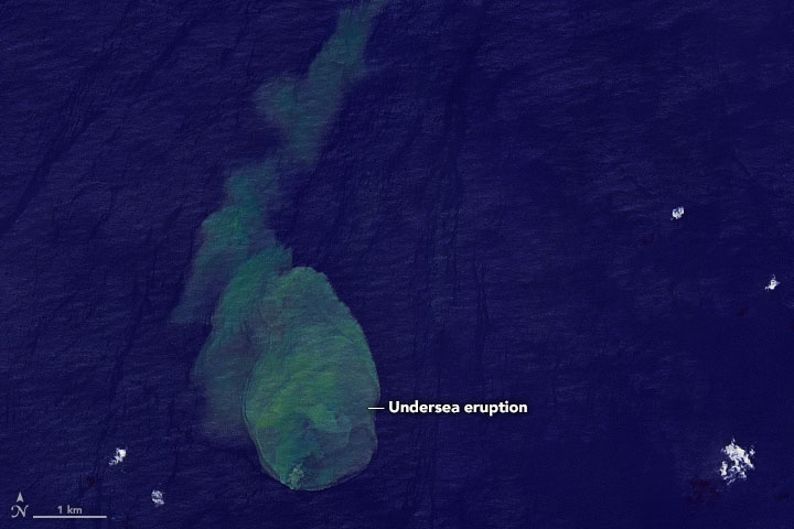
Discoloured Water Imaged by Landsat 9
On 14 May 2022, Landsat 9 acquired an image showing a plume of discoloured water extending from Kavachi's position. The discolouration indicates that material from the erupting vent was reaching or influencing the water column near the surface. Satellite imagery records the spatial extent and colour of such plumes but does not directly resolve the temperature or chemistry of the water involved.