
Position and Recorded Identity
Land Information New Zealand records the summit as Jollie Peak from its 1989 NZMS260 I36 topographic sheet. The LINZ Gazetteer lists it as place 23841. The Abbott, recorded by LINZ as Abbot, is a separate 2,630-metre summit southwest along the same ridge. Jollie Saddle lies east of the peak.
The New Zealand Alpine Club lists Jollie Peak at 2,544 metres in Rob Frost’s 2018 guide. Its east-ridge notes use the same name informally for a second point, Pt 2454. The Gazetteer’s Jollie Peak label identifies the 2,544-metre summit.
The glacier surveys of 1890–91
In 1890, George Edward Mannering published his observations of the Murchison Glacier. Travelling up the valley, he recorded tributary glaciers feeding the main body of ice. For the other side of the divide he drew on Burnett’s observations of glaciers on the Liebig Range’s eastern slopes, near the head of the Jollie River.
The government survey of 1890–91 measured how far the Murchison Glacier moved using rods set into the ice along a survey line. It also marked outcrops of bright red rock at several points along the Liebig Range. The Geoscience Society of New Zealand’s field guide identifies red argillite, a fine-grained rock, at an exposure in the lower Murchison Valley.
Ridge, Valley, and the Climbing Record
The 2018 alpine guide puts the east ridge in the context of a climb from the Murchison valley. The account links the basin northeast of the peak to the high crest and distinguishes the summit from the lower Pt 2454. More than a century after the early glacier surveys, the valley and the divide still provide the main bearings for locating the peak.
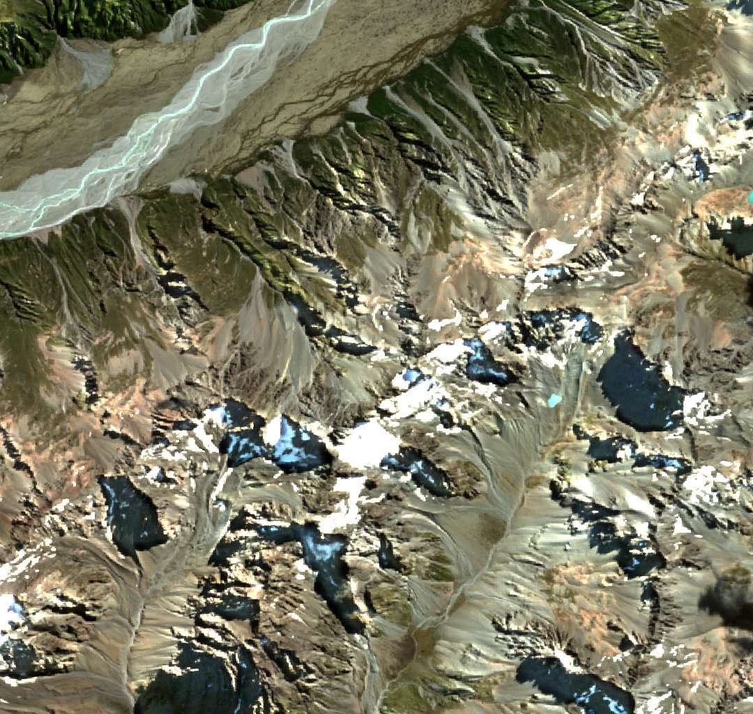
Satellite View, March 2026
A north-up Sentinel-2C image of Jollie Peak near the centre of the Liebig Range crest in this crop, with the braided Murchison River toward the upper left. Acquired on 21 March 2026. Contains modified Copernicus Sentinel data 2026.