
Position and Drainage
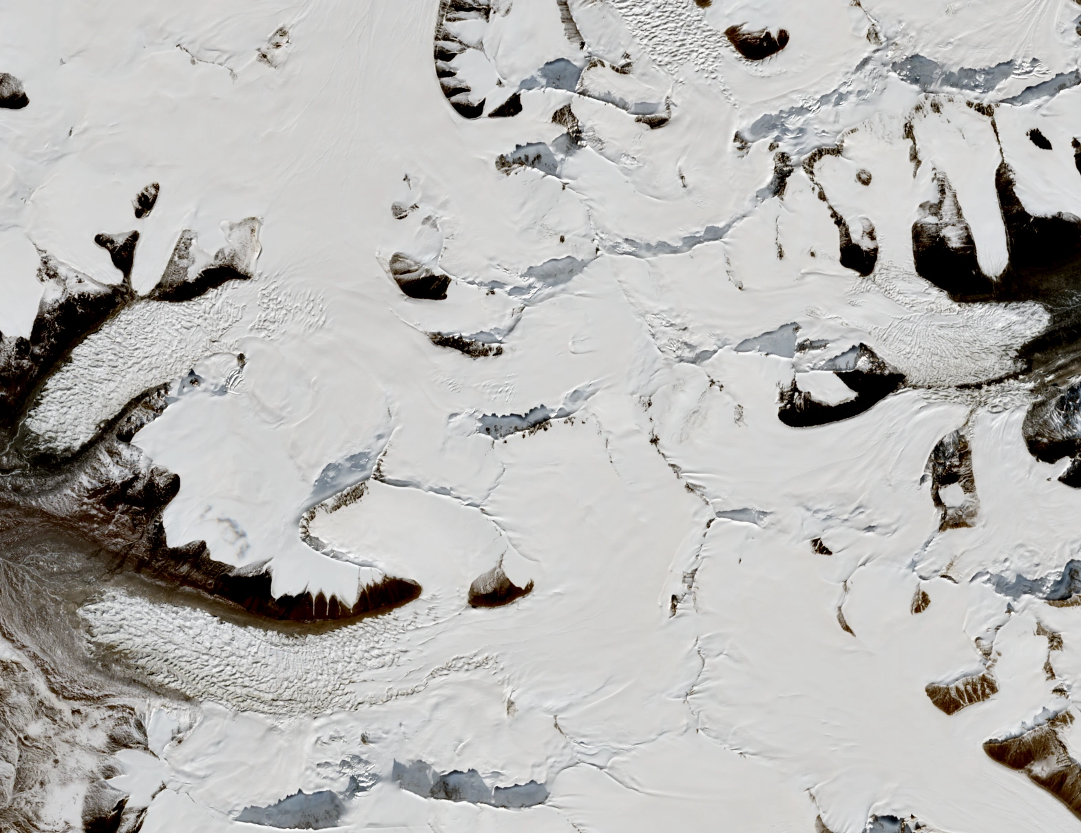
Li Bingyuan's field account identifies two arcuate ice streams, the northern and southern Jianggudiru glaciers, originating on the western slopes of the peak. Both curve westward and northwestward before converging and contributing meltwater to the Tuotuo River, one of the recognised headwaters of the Yangtze. On the eastern flank the Gangjiaquba Glacier occupies a separate drainage entirely, descending away from the western ice streams.
The spatial separation of these drainage systems on a single summit gives Jianggendiru Peak a distinct hydrological role within the Geladandong massif. The Tuotuo drainage has long been recognised as a Yangtze source area, and Li's terrain description ties the western glaciers of this named peak specifically to that system.
First Ascent, 2007
On 2 October 2007 the Qinghai-Tibet Friendship Mountaineering Expedition from Tottori set out from the second camp on the Gangjiaquba Glacier, east of the summit. Osamu Kato, Yoshiharu Murakami and Tamiyoshi Hashimoto began the final climb together, though Murakami and Hashimoto turned back at separate points. Kato continued alone and reached the 6,543-metre top at 3.25 p.m. The climb is recorded as the first ascent of the peak, which the route account places 5.4 km southwest of the main Geladandong.
Glacier Dynamics
A 2017 paper by Guang Liu and colleagues used Landsat and TanDEM-X observations spanning 1989 to 2015 to study these glaciers. In that study the southern branch covered about 32 square kilometres and the northern branch about 26 square kilometres.
Between 1989 and 1996 the southern glacier terminus retreated about 1 km, then advanced by more than 1 km in the two years from 1996 in the observations published by Guang Liu and colleagues. The 2017 study described this rapid advance as a glacier surge.
Two Glacial Branches in Satellite View
The Sentinel-2 image from 25 October 2026 places Jianggendiru Peak just right of centre, with the two curving Jianggudiru glacial tongues to the left and the main Geladandong summit at the upper right. Contains modified Copernicus Sentinel data 2026.