
The Ridge Above Narkanda
The shaded northern flank of the Hatu ridge carries dense silver fir, a contrast Thomas Thomson described when he climbed from Nagkanda in August 1847. A nineteenth-century print depicting the forested hills near Narkanda preserves that same character.
The Copernicus GLO-30 terrain model records approximately 3,200 m on the summit ridge. Captain Herbert's trigonometrical survey, cited by Thomson in 1847, placed the summit at 10,674 feet, and a book published in 1929 gives 10,500 feet with the date of ascent unknown. A ropeway alignment document places a proposed upper terminal near the summit temple at 3,173 m. Himachal Tourism publishes a figure of 3,400 m.
Survey Station and Measured History
Thomas Thomson and Captain Strachey climbed from Nagkanda in August 1847. Thomson records that Captain Herbert had already measured Hattu by triangulation as part of the Himalayan survey, and Strachey brought barometers to check against that value.
The Himachal Pradesh State Disaster Management Authority lists a rain and weather telemetry station named Hatoo Peak on the ridge within the Sutlej basin monitoring network. The ridge therefore appears in the documentary record from Herbert's triangulation and Thomson and Strachey's barometric visit through to that listed station.
Gneiss, Granite, and the Upper Forest
Richard Dixon Oldham, reporting fieldwork for the Geological Survey of India in 1888, recorded gneissose granite exposures on the Narkanda approach and noted well-formed orthoclase crystals visible in the rock at the Hattu summit. Van der Sleen, writing in 1929, described the summit gneiss in greater textural detail, noting micaceous layers enclosing both angular and rounded feldspar crystals.
Henry Collett's 1921 Flora Simlensis records cinquefoils of the genus Potentilla, gentians, and anemones on the upper slopes alongside a few stunted oak bushes. Collett also noted that the forest on the opposing aspect of the ridge differed in character, and these observations stand as period field records from systematic botanical survey work around Shimla.
The Hatu Mata Temple
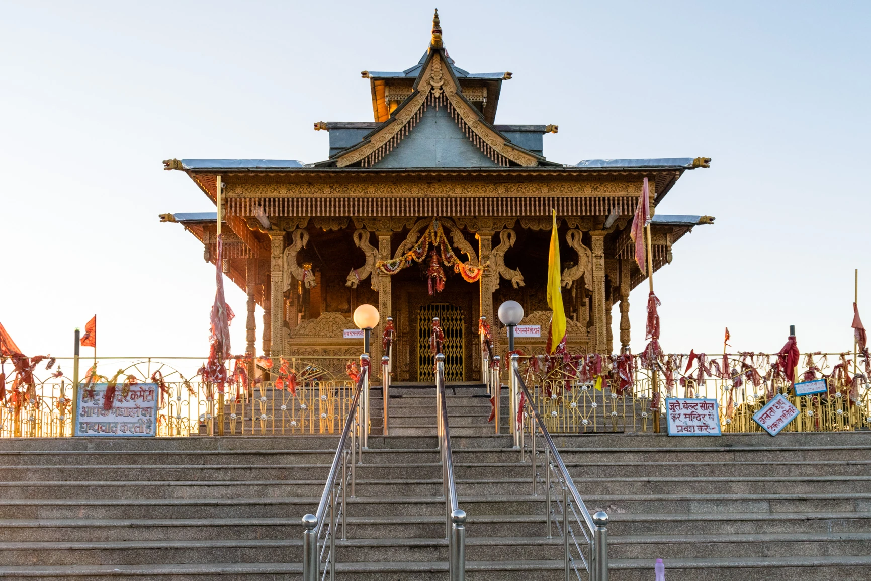
The Hatu Mata Temple stands on the summit ridge and is associated with the goddess Kali, built in the local wooden architectural tradition of Himachal Pradesh. The frontal view shows a tiered roof and timber facade with carved woodwork characteristic of hill-state temples in the region.
Himachal Tourism describes a walk of roughly 8 km from Narkanda through the forest to Hatu Peak. The same source separately identifies Jaw Bagh as an alpine meadow reached by a walk through dense oak forest.