
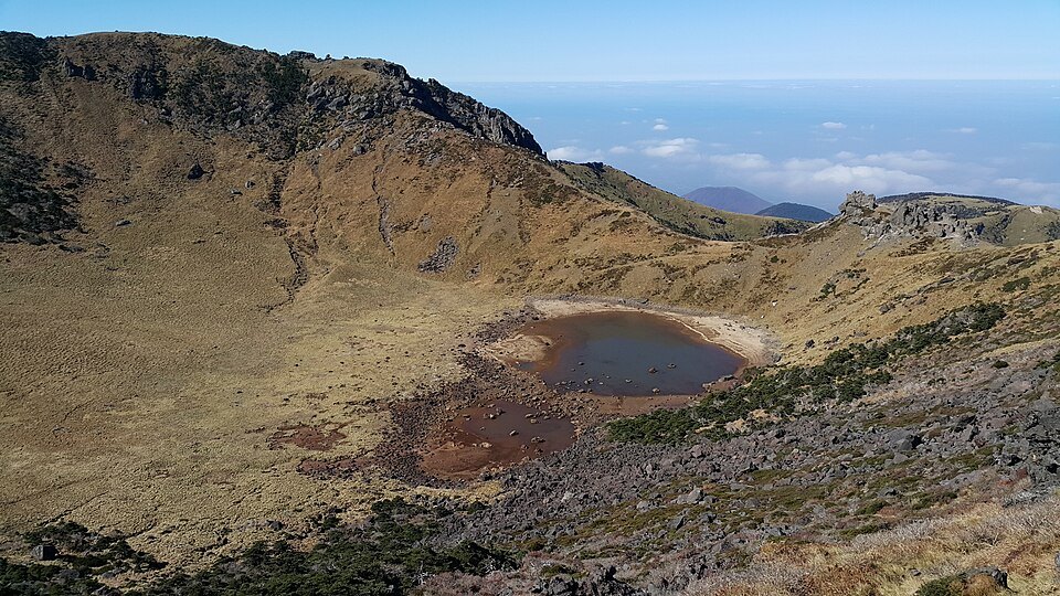
Volcanic landforms at Baengnodam and Yeongsil
According to Jeju's official information, the summit of Hallasan stands at 1,950 m. Baengnodam is an elliptical crater situated at that summit, and there is an elevation difference between the lake and the highest ridge. Nokdam-manseol — referring to the sight of winter snow lingering late into the season — is a scenic name passed down in Jeju tradition.
On the Yeongsil side, rock formations rising above the valley, forest, and the open terrain around Witseoreum appear in turn. If Baengnodam illustrates the shape of the crater, Yeongsil is well suited for observing the cliffs and ridges exposed by erosion on the mountain's slopes.
Seongpanak and Gwaneumsa: two approaches to the summit
The Seongpanak trail approaches the summit from the east of Hallasan, while the Gwaneumsa trail ascends from the north. Jeju National Park's official guidance highlights the deep valleys and significant elevation gain on the Gwaneumsa side. On a map, you can compare the point where the two trails converge near Baengnodam and the direction of their respective approach ridges.
The route from Yeongsil toward Witseoreum is well suited for reading the landscape of the southwestern slopes. If you are curious about both the summit terrain and the slope terrain, compare the locations of the Yeongsil rock formations, Seonjagiwat, and Baengnodam on the trail map.
Two sites inscribed alongside Hallasan
The 'Jeju Volcanic Island and Lava Tubes', inscribed on the UNESCO World Heritage List in 2007, groups Hallasan, Seongsan Ilchulbong, and the Geomunoreum lava tube system into a single property. At Seongsan Ilchulbong you can see the tuff cone left by an eruption that took place at the shoreline, while around Geomunoreum you can explore the underground passages left by flowing lava.
Adding Hallasan's crater and cliffs, you can compare what traces remain at the mountain summit, the shoreline, and underground respectively. The reason the three sites are preserved together is that they allow the formation processes of Jeju's volcanic landscape to be examined across different locations.