
The Namesake
Hagerman Peak takes its name from Percy Hagerman, who served as president of the Mollie Gibson Mine in Colorado's Elk Mountains. He was a devoted mountaineer and wrote accounts of climbing in the Elk Mountains. The peak stands at approximately 4,221 metres above sea level and lies near Snowmass Mountain.
Glacial Landforms and Geology
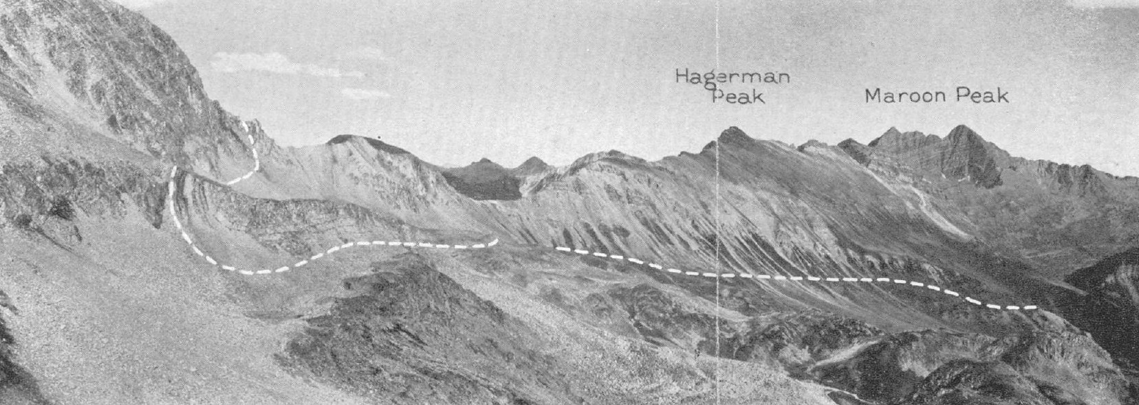
A 1922 field account published by The Mountaineers describes ice-related landforms on the approach terrain shared by Hagerman and Snowmass Mountain, noting the landscape of lake basins and cirque walls that characterizes this portion of the Elk Mountains. E. J. Mutschler's 1969 USGS geologic quadrangle of the Snowmass Mountain area later mapped this terrain in detail, documenting the rock units that form the ridge walls and basin floors visible in photographs of the area.
The 1922 account documents the landscape as it appeared at that time, and the glacial features it describes should not be assumed to retain the same extent today. The combination of that early field observation and the subsequent USGS geologic mapping provides a layered record of the same terrain across half a century of study.
Colorado Mountain Club Expeditions and the 1958 Record
A report published in the American Alpine Journal in 1958, signed by Elwyn A. Arps, President of the Colorado Mountain Club, describes ascents of Hagerman Peak along with Snowmass, North Maroon, and Capitol during the club's sixth Snowmass Lake outing. The report notes that the first such outing to the area was held in 1922.
LiDAR survey data records Hagerman Peak at 13,848 feet. The Colorado Mountain Club's route documentation describes the ridge connecting Hagerman to Snowmass Mountain as short but technically complex, reinforcing the summit's standing as a distinct objective rather than a simple extension of the better-known neighbor.