
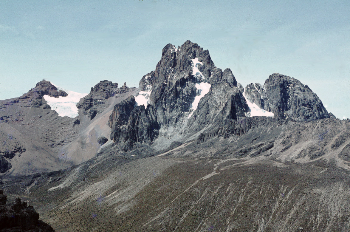
Three glaciers in a 1970s photograph
In Ronaldcameron’s photograph, taken around 1973, Gregory Glacier is the tongue of ice at the left. Krapf Glacier lies immediately to its right, with Northey Glacier at the far right. The photograph shows how the ice occupied separate hollows on the north side of the mountain.
Measuring the retreat from the air
Survey aircraft photographed the glaciers in February 1978 and in March 1986 and 1990. A ground mark measured below Gregory in December 1986 allowed Stefan Hastenrath and Raouf Rostom to map the glacier on all three sets of photographs. Between 1978 and 1990 its mapped area fell from about 80,000 m² to 61,000 m² and its length fell from 415 m to 365 m.
What the March 2011 survey found
Fog and snow during a 2010 visit made it difficult to tell whether the glacier still existed. When Rainer Prinz, Lindsey Nicholson and Georg Kaser returned in March 2011, they found that it had disappeared as a glacier. Some ice remained beneath surface debris, where its thickness was unknown. The team published the finding in 2012.