
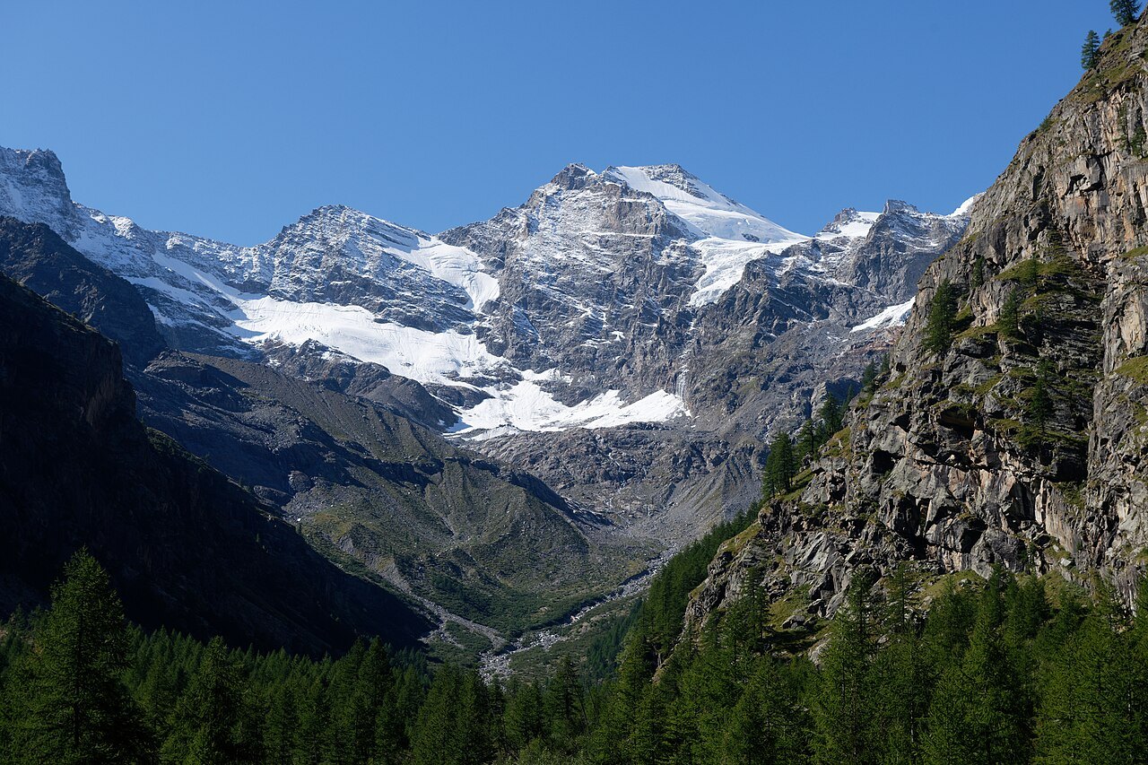
The Italian summit of the Graian Alps
At 4,061 metres, Gran Paradiso is the highest four-thousander lying entirely within Italian territory. From Valsavarenche the mountain presents itself at the head of a narrow valley, between forests and steep slopes. From Valnontey, in the municipality of Cogne, the massif shows the face of the Tribolazione glacier.
The first documented ascent dates to 4 September 1860. The British climbers John Jeremy Cowell and William Dundas made the climb with guides Michel Payot and Jean Tairraz. Fog prevented them from seeing the other peaks. Cowell returned to the summit with Payot the following day and, with the sky now clear, was able to observe the massif from above.
From royal hunts to ibex protection
The history of the park begins before the 1922 decree. In 1821 Carlo Felice banned the hunting of Alpine ibex, by then reduced to a few hundred individuals around Gran Paradiso. In 1856 Victor Emmanuel II established a royal hunting reserve. The mule tracks and hunting lodges still recall this period, during which the survival of the species depended in part on the surveillance of the reserve.
On 3 December 1922 Italy's first national park was established. Protection was extended to the fauna, flora, and landscape. Today the park also studies the relationship between ibex and alpine grasslands. In spring many males descend to find the first green shoots in the valley-floor meadows. As the snow melts, the animals are able to move to higher elevations, where the vegetation calendar is different.
Two refuges for reading the slope
Above Valsavarenche, the Rifugio Federico Chabod and the Rifugio Vittorio Emanuele II are two reference points for getting to know the mountain. The path to the Chabod passes from forest to alpine meadow. From the Vittorio Emanuele II sector you can also observe the north face of Ciarforon, distinct from the summit of Gran Paradiso. The two refuges are connected by a traverse path described by the Ente Parco.
Walking to a refuge shows how the landscape changes with altitude and allows you to see the glaciers from the slope. The ascent to the summit, by contrast, crosses glaciers and includes a final rocky section. The regional route profile helps distinguish the mountaineering itinerary from the excursions to the refuges.