
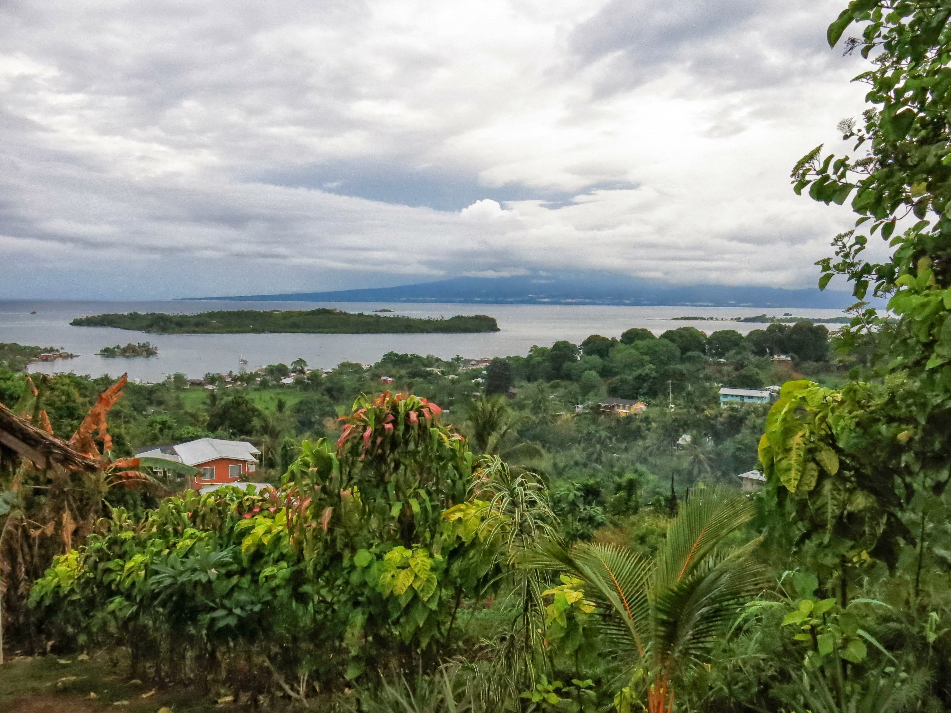
Relief and the shape of the island
A 2014 Solomon Islands government–UNDP water-adaptation programme recorded Maringe Hill as the island's high point at 180 metres, a figure independently noted in a Bishop Museum field biodiversity survey published in 2008. A tsunami field survey attributed settlement to the island's narrow coastal flats, where the terrain is comparatively level before rising ground begins close behind the shoreline.
A Bishop Museum survey conducted in the early 2000s sampled aquatic environments across the island's lowland elevation band from 0 to 25 metres, covering sites that included lowland ponds, mangrove swamps and rocky streams. The same report also notes the Gizo white-eye as a bird endemic to the island, though its identification lay outside the scope of the aquatic fieldwork.
Geology from shore to hillside
A 2008 SOPAC report by geologist Akuila K. Tawake, which reproduced a 1987 geological map, found that the older sedimentary rocks of the Konggu Formation underlie the younger Ghizo Volcanic Formation across much of the island. Within the Konggu Formation, the Mari Limestone Member is overlain by the Kaindo Arenite Member, and both units occur in central Ghizo and at Mari Point. The overlying volcanic formation consists mostly of breccias, in which the fragments are angular, and breccio-conglomerates, in which some clasts are rounded.
Field observations in the area around Titiana, west of Gizo town, recorded mixed breccia containing fragments of basalt, andesite, diorite and tonalite embedded in finer weathered material. Basaltic breccia crops out to the west of this zone, with mixed breccia lying above it, while andesitic breccia was identified higher in the sequence across the northern and central parts of the island. The survey noted that construction crews used the western basaltic breccia as road material in 2004, and in 2005 observed that it held up more durably than the highly weatherable calcareous sedimentary rock found elsewhere on the island.
The 2007 earthquake and the southern shore
On 2 April 2007 local time, a magnitude 8.1 earthquake occurred offshore. A field survey conducted by Japan's Port and Airport Research Institute measured inundation heights of approximately 4 to 5 metres at parts of Ghizo's southern shore and northern Simbo. Interview accounts collected during that survey indicated that several waves arrived, with timing that differed by location. USGS fieldwork carried out in 2007 gathered geologic data on land-level changes and sediment deposition associated with the event.
A peer-reviewed community study published in 2021, based on fieldwork conducted with Ghizo communities between 2011 and 2013, examined how recovery after the 2007 tsunami varied between settlements. The study found that access to hill land, local hazard knowledge, and customary land relations were factors that shaped recovery outcomes differently depending on where people lived on the island.
The view from the slopes above town
The photograph shows vegetation and houses covering the sloping ground that rises above Gizo town and its harbour, with cloud obscuring the distant island terrain. The hillside appears densely vegetated, and the buildings extend from the waterfront up into the lower slopes, illustrating how closely the town sits against the rising ground behind it.