
Volcanic Rock and the Shape of the Cirque
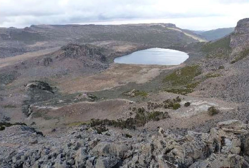
Lake Garba Guracha fills a northeast-facing hollow carved by a glacier. Cliffs and steep slopes on its south and southeast sides rise up to 140 m, exposing basalt lava above layers of trachytic tuff, a rock made from consolidated volcanic ash. When the water level is high enough, the lake drains over a rock sill toward the Togona valley.
Botanical Collections from the South Crest
A herbarium record dates a sedge collection on the crest south of the Garba Goracha campsite to 2 November 1973, at 4,100 m. That day, O. Hedberg also collected specimen 5639 beside a shallow pond at the same recorded elevation. Ortiz and Vivero Pol cited the specimen in 2005 when describing Senecio balensis, a small, yellow-flowered member of the daisy family.
Sediment Cores and the History Beneath the Lake
In February 2017, researchers anchored a raft in 4.8 m of water and recovered two overlapping sediment cores reaching 15.50 m below the lakebed. The dated sequence goes back approximately 15,900 calendar years. In the lower layers, mineral particles from the surrounding rock predominate. Farther up the core, organic matter becomes more plentiful as the lake and its surroundings change after the ice retreats.
The Ridge Within Bale Mountains National Park
The south rim lies within Bale Mountains National Park, legally protected and demarcated in 2014 following earlier conservation work. In 2023, UNESCO added the park to the World Heritage List in recognition of its scenery and biodiversity. The rim and the small lake below belong to the park’s cold high country. The same boundaries extend to forests farther down the massif.