
Names, Maps, and Elevation Records
Geologist Augusto Gansser made five field trips to northern Bhutan between 1963 and 1977. He called the long crest Table Mountains on his early maps, estimated its length at nearly 15 kilometres and recorded Zongophu Kang as the local name of its highest rise. In the 1985 Alpine Journal, M. S. Kohli listed Table Mountain in Lunana at a tentative 7,000 m. A geological map published in 2011 labels it Zongphu Kang at 7,100 m.
The Jigme Dorji National Park management plan uses Gangchen Singye and gives an elevation of 7,094 m. Cartographer Günter Seyfferth identifies a main high point of 7,085 m from topographic sources and field photographs. A report in Japanese Alpine News maps a point called Singey Kang at 6,930 m above the Raphstreng Glacier, on the wider ridge system.
Landform and Rock Structure
Gansser described the broad upper edge as a layer of sedimentary rock that dips gently north and contains fossils in places. Beneath it lie leucogranite, marble and granitic gneiss. The layers help explain the profile seen from both sides of the divide. In the north they follow the gentler slope towards the Tibetan plateau. In the south they end in steep cliffs, where Gansser observed ice falling from hanging glaciers to feed the glaciers at the base.
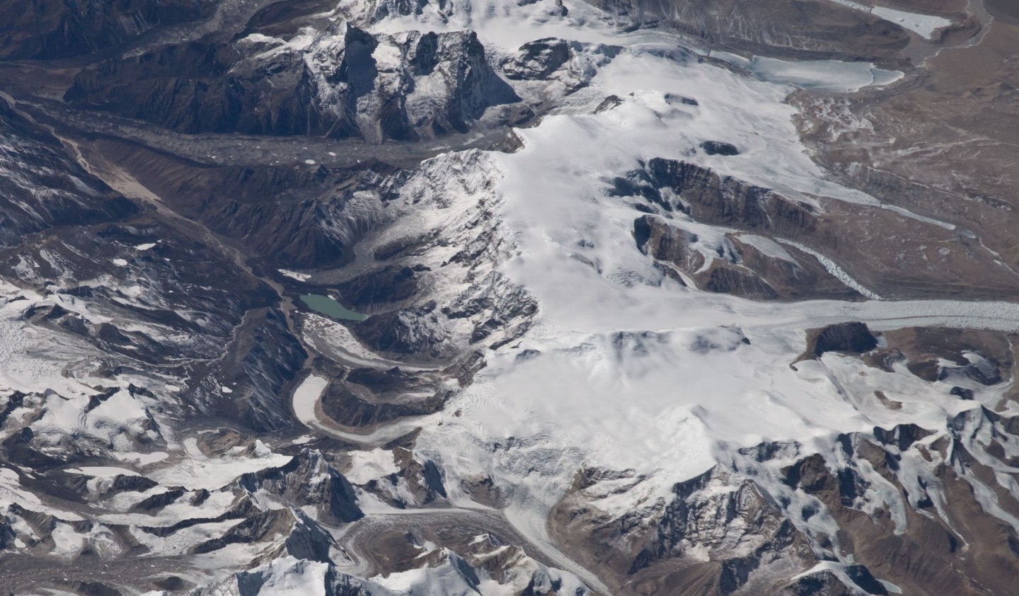
At the foot of the south wall, Gansser came upon a dark blue-green lake below hanging glaciers and a steep moraine. His account records stories he heard in Lunana about spirits in the mountains and lakes. It also describes highland settlements and yak herding in the surrounding valleys. In October 2013, Roger Nix photographed the south wall and its glaciers from the ridge above Chozo.
Glacial Lakes and Field Investigations
Water from the mountains above Lunana gathers in glacial lakes. In 2019 Bhutan’s National Center for Hydrology and Meteorology used drones and GPS to survey parts of the basin. The team measured the depth of Baychung with sonar. Floating ice prevented the same measurements at Thorthormi during that visit. In 1994 a flood from Lugge Tsho travelled down the Pho Chhu valley. Residents of Lunana evacuated after a separate breach below Thorthormi on 20 June 2019.
A 2025 Journal of Glaciology study used monthly images from 2017 to 2023 to follow the movement of ice in Lunana. As features on the glacier surface shift between images, the distance they move over a known time gives the speed of the ice. Raphstreng generally accelerated in summer and slowed in autumn and winter. The nearby Thorthormi Glacier sped up across consecutive years, and its front broke apart in 2022.
View from Orbit
The International Space Station photographed Gangchen Singye on 6 February 2010. Günter Seyfferth identified the massif and neighboring peaks in this frame. The view shows how the ice-covered crest links tributary glaciers on both sides of the divide.