
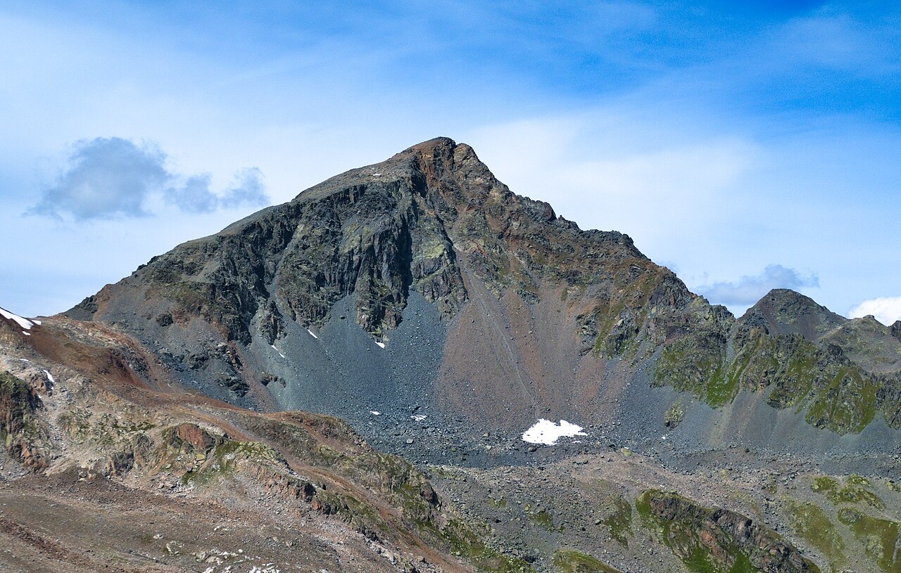
Rock and silhouette
Switzerland Tourism describes the mountain's pyramidal form and associates its dark appearance with amphibolite, a metamorphic rock. A 2023 engineering field report commissioned by the municipality of Davos identifies amphibolite at Schwarzhorn, alongside orthogneiss at the neighbouring Flüela Wisshorn and paragneiss at Pischahorn, documenting a range of metamorphic rock types among peaks that stand in close proximity.
The contrast in appearance between Schwarzhorn and the Wisshorn across the pass is documented in historical accounts. Jakob Marzohl, writing in 1967, observed the light rock walls of the Wisshorn from the Schwarzhorn summit, alongside dark rubble on the Schwarzhorn's eastern side. The name Schwarzhorn, meaning dark or black peak, appears in tourism materials alongside this visual contrast.
A pass road before a summit destination
The Flüela Pass connects Davos with Susch. According to the Historical Dictionary of Switzerland, the present road was built in 1866 and 1867, with the pass hospice dating to 1868 and 1869. Johann Martin Steiger produced a watercolour of the view from the Susch-side switchbacks in 1891, reproduced as a photomechanical copper print in an 1893 volume on mountain passes and postal routes held by the Swiss National Library, with Schwarzhorn visible in the background.
The Graubünden State Archives hold a separate photograph, catalogued at around 1930, showing a PostAuto travelling the Susch–Davos road with Schwarzhorn behind the vehicle. The 1891 watercolour and the 1930 photograph are roadside depictions from two different media, each placing the mountain within a travelled landscape.
Marzohl's ascent by the eastern flank
One documented ascent from the SAC archive comes from Jakob Marzohl, who published an account in 1967 describing a journey that began with a train to Davos and a PostAuto connection to the Flüela-Hospiz. From there he crossed to the Schottensee and climbed the eastern flank of the mountain through debris fields and old morainic material, the accumulated deposit of former glacial activity.
Marzohl reached the summit in low evening sunlight. From that position he could see the Wisshorn's pale walls across the pass, the Radüner Rothorn to the south, and what he described as ice on the Radönt. He descended into the Dischma Valley. His account gives the elevation as 3,146 metres, a figure consistent with the federal swissNAMES³D point for the named summit feature.