
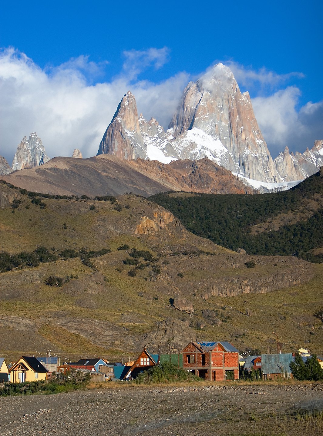
A Summit with Disputed Measurements
The exact altitude of Cerro Chaltén has received different values depending on the source consulted. UNESCO, in its dossier on Los Glaciares National Park, cites 3,375 m, while the profile compiled by Andeshandbook records 3,406 m and the master reference data notes 3,405 m. This divergence reflects the difficulty of precisely measuring summits whose complex geometry and extreme weather conditions hinder geodetic surveys. None of these values should be taken as definitive without explicit attribution to its source, and the debate over the exact figure forms part of the mountain's documentary history.
What is indisputable is the geomorphological context in which it sits: UNESCO describes the Los Glaciares ensemble as a landscape shaped by active and continuous glaciation, with high granite peaks and cold Magellanic forests. The park is contiguous with protected areas on the Chilean side, and together they form a transboundary mosaic of high mountain terrain shared between Argentina and Chile.
The Brecha de los Italianos and the First Ascent
Before any team reached the summit, the mountain attracted expeditions that left their mark on local toponymy. Andeshandbook documents the early Italian attempts and the geographical feature that preserves their memory: the Brecha de los Italianos, a col that marks one of the historical lines of approach to the walls of Chaltén. These attempts established the technical knowledge of the terrain that later expeditions would draw upon.
It was a French team that reached the summit for the first time. According to the management plan of the Administración de Parques Nacionales, Lionel Terray and Guido Magnone completed the first ascent in 1952. Andeshandbook specifies that the culminating moment came on 2 February of that year and that the route followed was the south spur. This ascent, carried out in Patagonian conditions without modern protection technology, was recorded as one of the founding milestones of technical alpinism in South America.
Glaciers, Forests, and the Protected Landscape
The immediate surroundings of Fitz Roy combine two very different scales of experience. The Administración de Parques Nacionales draws an explicit distinction between viewing the landscape from points such as Laguna Torre — accessible to a broad public — and technical climbing on the walls of Fitz Roy itself and Cerro Torre, which demands specialist training and equipment. This distinction reflects the functional diversity of a park that harbours both Magellanic forest ecosystems and one of the most extensive continental ice fields on the planet outside the poles.
Los Glaciares receives its UNESCO recognition precisely because of the ongoing glacial dynamics: the glaciers descending from the Southern Patagonian Ice Field shape the relief, feed the great southern lakes, and define a hydrological cycle of regional significance. The granite of Chaltén, carved by ice over millions of years, is in this sense both the visible result of that process and its most photogenic emblem.
Name, Identity, and Shared Territory
The coexistence of the names Chaltén and Fitz Roy on the same summit condenses layers of history: the Aonikenk designation, recorded by UNESCO as "smoking mountain," predates any European cartography by centuries, and its persistence in the name of the nearest settlement — El Chaltén — reflects the institutional recognition of that origin. The toponym Fitz Roy, by contrast, derives from a later cartographic tradition.
The transboundary character of the landscape adds another dimension to the territory: Los Glaciares borders Chilean protected areas and the high-mountain massif does not respect the political borders drawn on maps. This ecological and orographic continuity has led to coordinated management approaches between both countries, in which the Chaltén massif occupies a central position both from the standpoint of natural heritage and of high-level alpinism.