
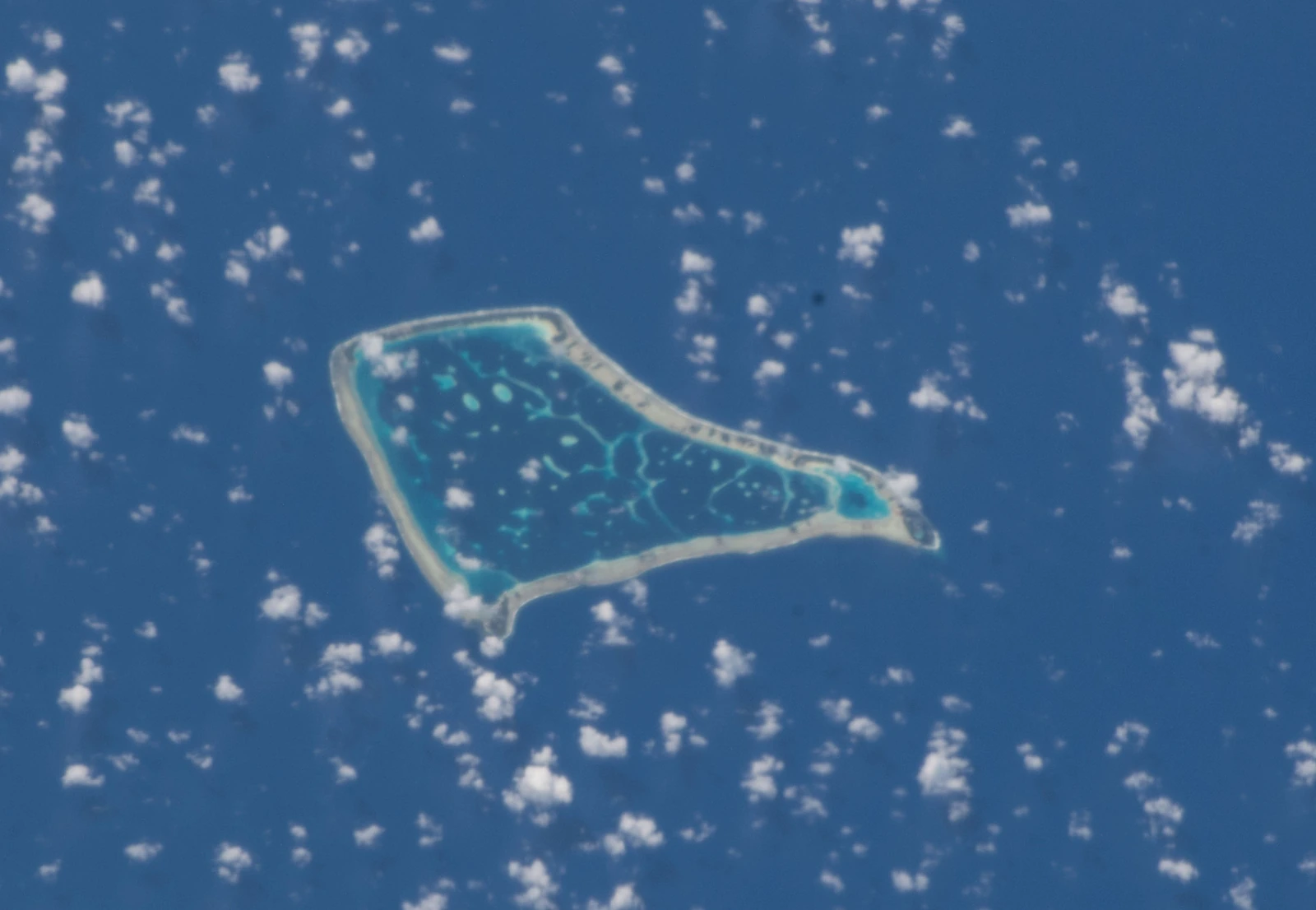
Coral Landform and Reef Geology
Tokelau's atolls sit atop volcanic bases that have long since subsided below sea level. Living coral reefs grew upward from those foundations, and over time shallow reef flats collected sand and broken coral fragments, gradually forming the low, flat islets visible today. The Tokelau government places the group's atolls at roughly 3 to 5 metres above sea level. Each individual islet — called a motu — is a reef islet, its surface material a product of biological and wave-driven deposition rather than bedrock exposure.
The Government of Tokelau records Fakaofo as the southernmost atoll in the territory and lists 62 islets enclosing a lagoon of approximately 50 square kilometres, with total dry land reaching about 4 square kilometres. The NASA astronaut photograph ISS056-E-9999, acquired on 4 June 2018, shows the characteristic ring structure clearly: a discontinuous rim of islets interrupted by reef passages, the lagoon interior a distinct shade lighter than the surrounding open ocean.
Settlement on Fale and Fenuafala
Fale, on a smaller motu on the western side of the atoll, is Fakaofo’s main settlement. The Government of Tokelau records that a second settlement was established on the nearby larger islet of Fenuafala in 1960, created to relieve crowding on Fale. The same village profile locates Fakaofo’s hospital and Tialeniu School at Fenuafala.
Fenuafala lies two kilometres west of Fale according to the village profile. The two settlements therefore occupy separate reef islets on the western side of the same atoll.
Cyclone Percy and Post-Storm Survey Findings
In February 2005, Cyclone Percy drove storm surge and waves across parts of Fakaofo. Following the storm, NIWA field scientist Doug Ramsay visited in July 2005 with assistance from the Tokelau Apia Liaison Office to document physical changes at Fakaofo and the neighbouring atoll of Nukunonu. The survey recorded erosion and scouring along the Fenuafala shoreline near the school playing field, an area where coastal vegetation had previously been cleared. NIWA's findings distinguish between natural coastal features — coral beaches and rubble deposits — and human-constructed walls, treating each separately in the damage record.
The 2005 storm and the subsequent NIWA field programme are documented in Tokelau's national disaster risk planning records as well as in NIWA's 2006 annual report. The post-storm observations at Fenuafala illustrate how low-lying reef islets, where vegetation removal leaves shorelines directly exposed, respond differently to wave energy than sections of coast where natural ground cover remains intact.