
Structure and Setting
At 1,651 m, Eyjafjallajökull is an elongated ice-covered stratovolcano in southern Iceland. Beneath its glacier sits a summit caldera approximately 2.5 km wide, the collapse structure of an older eruptive system. The volcano lies west of Katla, a separate volcanic system that the Icelandic Meteorological Office distinguishes carefully from Eyjafjallajökull despite their geographic proximity.
Prior to 2010, the most recent well-documented eruptive period ran from December 1821 to January 1823. That interval between the 1821–1823 activity and the 2010 eruption meant monitoring infrastructure and international awareness of Eyjafjallajökull's hazards had not been tested against a live event within living memory.
The 2010 Eruption in Two Phases
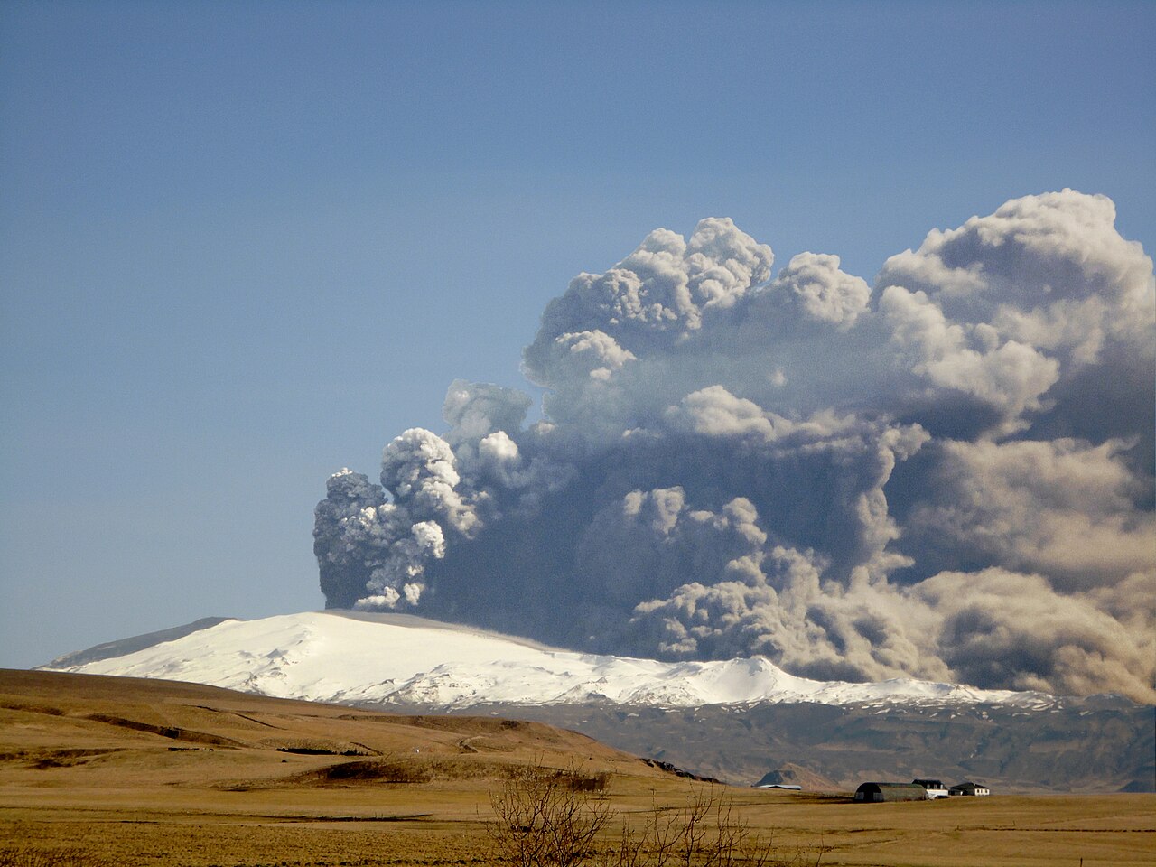
The 2010 activity unfolded in two successive phases. The first began in March 2010 at Fimmvörðuháls, a flank location between Eyjafjallajökull and the adjacent Mýrdalsjökull glacier, producing lava at the surface without significant explosive activity. The second phase began in April 2010 when eruption shifted to the summit vent, directly beneath the ice cap. There, ascending magma met meltwater from the overlying glacier, promoting fragmentation of erupted material into fine ash — a process the Icelandic Meteorological Office documented as the key factor determining eruption style.
Meltwater generated by the heat of the April eruption flooded valleys on the volcano's flanks. The fine-grained ash produced at the summit vent was carried by atmospheric circulation across European airspace, where it caused widespread interruption of civil aviation. The Icelandic Meteorological Office tracked the changing direction and density of ash transport throughout the episode.
Ice, Magma, and Eruption Character
The 2010 eruption generated extensive meteorological and volcanological documentation that has since informed understanding of volcanic ash hazards. The Smithsonian Global Volcanism Program's records situate the event within Eyjafjallajökull's longer eruptive history, while Icelandic Meteorological Office archives capture the plume's evolving character in near-real time. These records show that the physical interaction between ice and magma, rather than eruption magnitude alone, determined the fine-grained character of the ash and the reach of its effects.