
Shield Geometry and Rift Setting
Erta Ale is a basaltic shield, a form defined by low-angle slopes built from successive fluid lava flows rather than the steep cone profile of a stratovolcano. Its approximately 50 km breadth reflects this effusive construction history, with lavas spreading laterally over long periods rather than accumulating vertically in one place. The Smithsonian places it within the Erta Ale Range, itself part of the broader Afar Triangle, where the African, Arabian, and Somali tectonic plates interact.
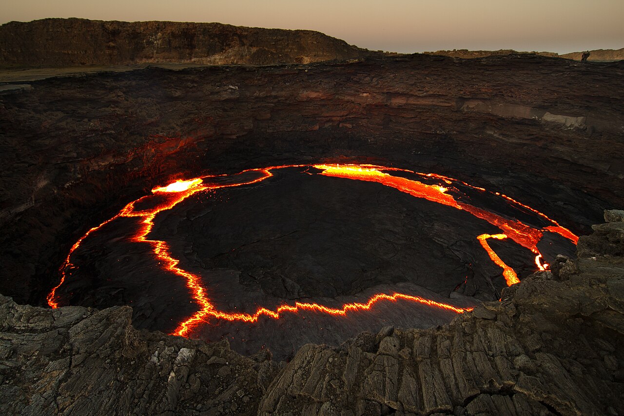
The summit caldera measures roughly 0.7 km by 1.6 km and contains steep-walled pit craters. The Smithsonian also identifies a larger depression located southeast of the summit, separate from the summit caldera. The pit craters within the summit caldera are the features associated with the documented lava lake activity.
The Lava Lake Record
The Smithsonian's documentation of Erta Ale records a lava lake within the summit pit craters observed since at least 1967. The activity level and the depth of the lake surface within the crater have varied over the decades of observation, rising and subsiding with shifts in the underlying volcanic system.
NASA Earth Observatory reported that Landsat 8 satellite imagery acquired in January and February 2017 detected lava lake activity and outgassing at Erta Ale's summit, as well as additional thermal hot spots on the southeastern slope of the volcano. These observations reflect the value of remote sensing for monitoring a site whose terrain makes direct, sustained observation difficult.
Elevation and the Danakil Context
Erta Ale's summit elevation of 585 m above sea level understates its physical scale when the surrounding landscape is considered. The Danakil Depression includes terrain that sits below mean sea level, making it among the lowest exposed land surfaces on Earth. A volcano rising more than 600 m above that base represents a substantial edifice; the sea-level datum compresses its apparent height when expressed as a single elevation figure.