
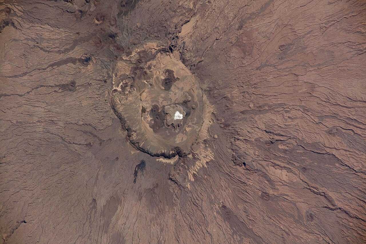
A Shield Built Above Sandstone
Emi Koussi was constructed atop an older sandstone basement, its volcanic mass accumulating over time into a structure roughly 60 by 80 kilometres across. The shield's low angle is characteristic of this type of volcanic landform, in which material spreads broadly rather than piling steeply. The Smithsonian Global Volcanism Program records the summit elevation at 3,415 metres; NASA Earth Observatory has published a figure of 3,445 metres, and both values appear in the literature.
The highest point on the mountain lies on the southern rim of a large overlapping caldera complex spanning roughly 12 by 15 kilometres. This complex is the dominant feature of the summit zone and is distinct from the Era Kohor, a smaller inner depression approximately 2 to 3 kilometres wide and around 350 metres deep that sits within it. The Smithsonian catalog also identifies craters, lava domes, scoria cones, and lava flows as components of the volcanic landscape, indicating the range of eruptive styles that have shaped Emi Koussi over time.
The Era Kohor Depression and Its Salt Deposits
Within the inner Era Kohor depression, salt deposits occupy part of the floor and produce a brightness clearly distinguishable from the surrounding darker volcanic terrain when viewed in orbital imagery. NASA Earth Observatory has noted this contrast, which makes the depression one of the more visually striking features of the summit zone as seen from space.
The broad shield, the overlapping caldera complex, the sunken Era Kohor, and its salt-brightened floor together give Emi Koussi a summit geography of considerable complexity. The relationship between the larger caldera complex and the smaller inner depression reflects successive phases of volcanic activity and subsequent modification. The Smithsonian catalog records no confirmed Holocene eruptions, leaving the timing of the most recent activity unestablished.
Position Within the Tibesti and the Sahara
The Tibesti Mountains form the highest range in the Sahara, and Emi Koussi, at the range's southeastern end, holds the distinction of being the highest individual summit across the entire desert. Its location in northern Chad places it within the volcanic mass of the Tibesti, an abrupt intrusion into the surrounding Saharan reg and erg landscapes. The scale of Emi Koussi — tens of kilometres across at the base, more than three kilometres above sea level at its caldera rim — reflects the cumulative output of a long eruptive history on a stable continental interior.