
Name, Form, and Early Observation
In 1946 E. V. Timashev observed the peak from Marble Wall and recorded a massive, twin-headed summit east of Khan Tengri that he described as looking like a tent. Shatyor is the Russian word for a tent. Timashev could see the snow-covered Northern Inylchek Glacier below Khan Tengri.
Elevation figures vary across sources. A Russian mountain survey overview records 6,636 m for Shatyor, while the Kazakhstan–China border protocol records 6,637 m at the East junction. The climbing catalogue lists West Shatyor at 6,511 m and gives it the alternate name Peak of the 50th Anniversary of the Komsomol. Other aerial and expedition sources give approximately 6,600 m for that western summit.
First Ascent and the 1974 Traverse
The specialist historical catalogue dates the first recorded ascent of East Shatyor to 1968, and the 1968 participant archive documents early expeditions working the Northern Inylchek basin during that period. In 1974 Boris Solomatov led a team on a full traverse from Khan Tengri to Marble Wall, crossing Saladin, the Peak of the 50th Anniversary of the Komsomol, and East Shatyor before continuing north along the Meridional Ridge. The team's report names nine points along the route.
The 1990 Horseshoe Traverse
In 1990 Valery Khrishchatyi and his team completed the first long horseshoe traverse of the Southern Inylchek Glacier, running from the Pobeda–Jengish Chokusu massif to Khan Tengri. The field diary records reaching East Shatyor on 19 August 1990 after a cold night, with the route continuing west along Tengri-Tau toward West Shatyor and Saladin. On the summit they found the note left by Solomatov's 1974 team. The traverse diary attributes a total journey of 73.6 km over 15 days, with approximately 60 km above 6,000 m.
A 1991 party recorded steep ice steps on the northern flank and snow cornices overhanging the ridge that links the two peaks. Heavy snow and wind slowed the team, and they turned back below the eastern summit.
Ridge Position and Orbital Photograph
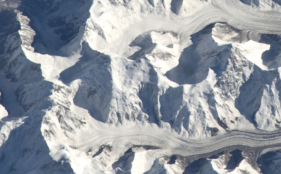
An astronaut photograph taken from the International Space Station on 6 September 2010 (ISS024-E-13719) shows the Tengri-Tau from the north. East Shatyor appears just left of centre in the frame, with West Shatyor immediately to its right and the Northern Inylchek Glacier in the foreground. Anatoly Djuly’s independent aerial photographs give another view of both summits and the ridge around the head of the glacier.