
Iron Geology and the Yekepa Mine
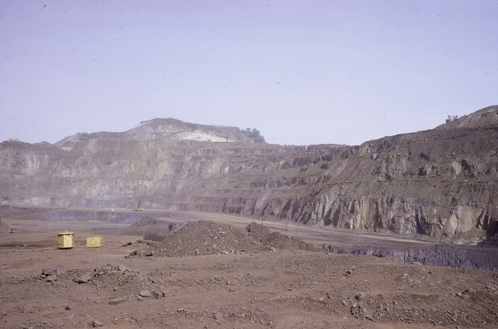
The U.S. Geological Survey mapped ancient iron-bearing rock on the ridge as part of the Nimba Supergroup. Open-pit mining near Yekepa began in the 1960s. In Fred van der Kraaij’s 1976 photograph, ledges cut into the slopes show how the miners reached successive layers of ore.
Images from 1974 and 2014, compared in the atlas Landscapes of West Africa, show how mining and its roads changed the ridge and the adjoining lowlands. That study points to two traces of the old workings: benches cut into slopes and a former pit known as Blue Lake.
The East Nimba Nature Reserve
Liberia established East Nimba Nature Reserve by law in 2003. It protects part of the Liberian ridge. Across the border, Guinea and Côte d’Ivoire share the inscribed Mount Nimba World Heritage property. Liberia added its reserve to its own UNESCO Tentative List in 2017 as a possible extension.
A field study recorded the Nimba otter-shrew (Micropotamogale lamottei) in the East Nimba reserve and in the surrounding Liberian mountains. The small mammal forages in fresh water, where the streams and the forest around them form a single habitat.
Community Co-Management
When the Forestry Development Authority began marking the reserve boundary, nearby residents asked for further discussion. In September 2010, the authority and representatives of the Sehyi, Gba and Zor communities signed an agreement to manage the reserve together, according to the 2014–2018 plan.
Liberia’s Forestry Development Authority announced a renewed agreement in December 2022. The ridge has become a place where neighbouring communities and conservation officials have to agree how to use forests that have long supported local livelihoods.
Relationship to the Broader Nimba Massif
The Nimba range crosses Liberia, Guinea and Côte d’Ivoire. Its main summit, at 1,752 metres, lies on the border between Guinea and Côte d’Ivoire. The old mine and the protected forests on the Liberian side sit along the continuation of the same mountain range.