
The edge of an old reef
Nauru's National Environmental Management Strategy describes the island as a raised coral limestone formation resting on a submerged volcanic seamount. From the coast, the terrain climbs through a limestone escarpment to the central plateau that Nauruans call Topside, and Command Ridge runs along the western edge of that upland. The government environmental strategy regards Command Ridge and some elevated ground on the southern part of the island as probable remnants of the former atoll rim.
Occupation and return
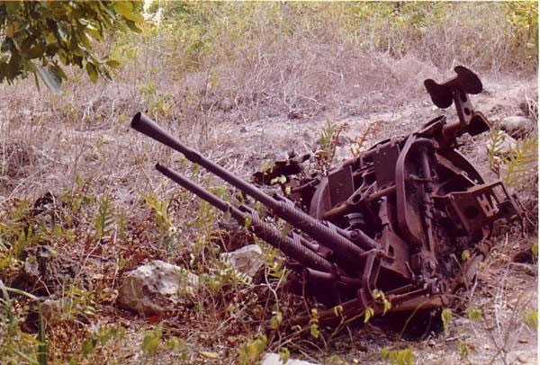
Japanese forces occupied Nauru in 1942. A 2012 field due-diligence assessment of Command Ridge recorded surviving fortifications including gun mountings, zigzag trenches, and a stone bunker bearing Japanese writing. The local surrender was signed aboard HMAS Diamantina on 13 September 1945, as recorded in Australian War Memorial film. During the occupation, Japanese forces sent Nauruans into exile on Chuuk. Nauru commemorates the return of survivors from Chuuk on 31 January 1946.
Antennas on the ridge
On 16 December 2024, the Nauru government inaugurated an internet satellite gateway on Command Ridge. The inauguration took place beside the new parabolic antennas. The 2012 field survey placed wartime radio equipment among the finds in the vicinity of the modern communications tower.