
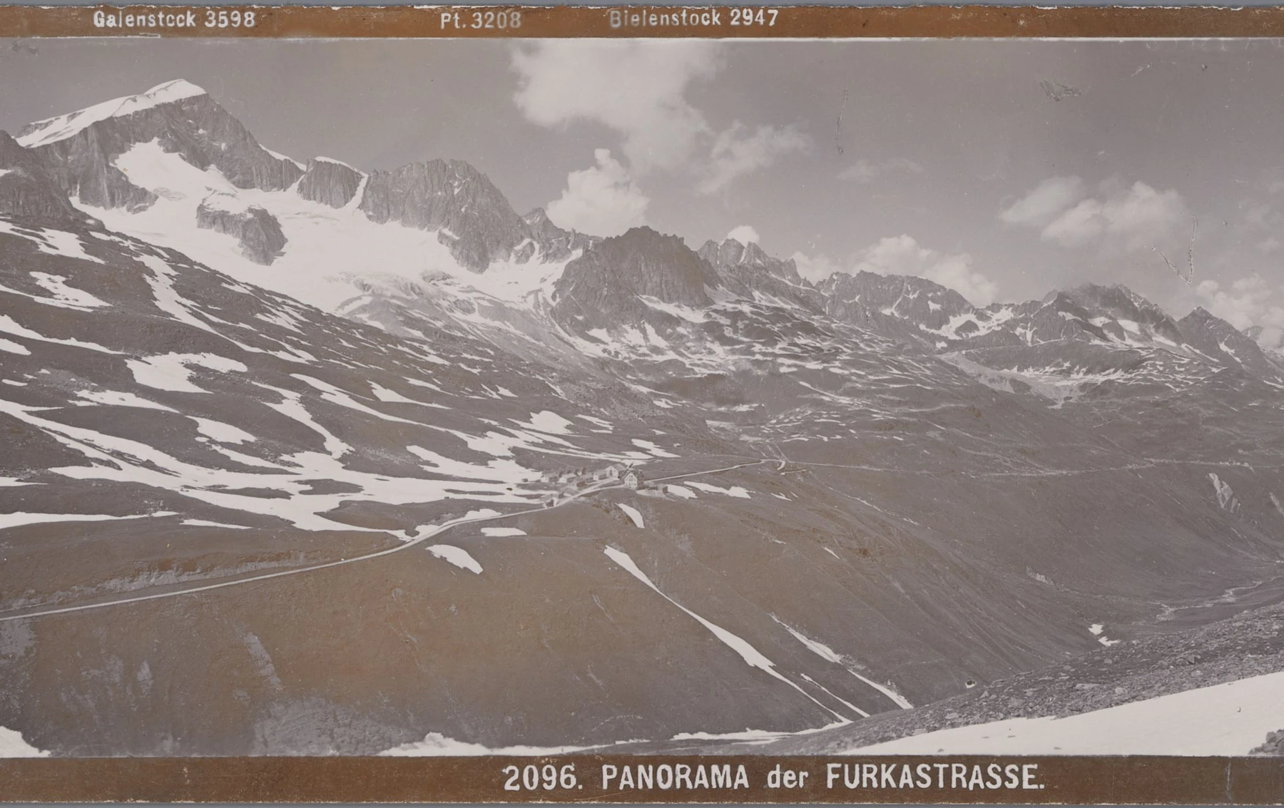
The peak in the Furka panorama
In their panorama dated 1897–1924, the Wehrli brothers printed “Bielenstock 2947” above the peak. The historic Baedeker handbook places the pinnacles of Bielenstock beside Siedeln Glacier on the approach to the Furka Pass. Today the Swiss federal gazetteer names the peak Chli Bielenhorn, and the Swiss Alpine Club gives its elevation as 2,940 metres.
The road on the lower slope was built in the 1860s. Realp’s municipal history dates the road to 1866 and connects its construction to the growth of stagecoach services and hotels in the valley.
Climbers on the ridge
The 1888 Swiss Alpine Club yearbook lists Bielenstock among the outings of August Näf and Carl Seelig. On 22 July 1903, Helene Kuntze, Josef Lochmatter and the young Gabriel Lochmatter climbed from the Furka road above the Stelli pastures. The club’s account records their crossing of a notch in the Bielenstock ridge on the way to Gletschhorn.
Surveying from Bielenstock Nord
On 29 September 1918 the federal survey used a Zeiss camera at Bielenstock Nord, a station at 2,832 metres above sea level. A surviving glass plate shows the land to the northeast, within the municipality of Realp.
To measure mountain terrain, surveyors took overlapping photographs from two precisely located points. They used features that appeared in both photographs and the known distance between the camera positions to measure the shape of the land for the new topographic maps.
The south face and the retreating ice
The steep rock of the south face appears in the Swiss Alpine Club’s guides to the mountain. The club’s account of the traverse from Sidelenhütte to Albert-Heim-Hütte records that part of the route once crossed the Tiefengletscher. With the glacier’s retreat, that section now lies on solid ground.