
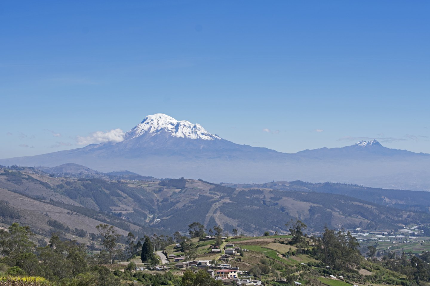
Anatomy of a composite stratovolcano
The Instituto Geofísico of the Escuela Politécnica Nacional (IG-EPN) describes Chimborazo as a composite stratovolcano, that is, one built up by the accumulation of successive eruptions that deposited lavas, pyroclastics, and flow deposits over geological time. Its profile as recorded by the IG-EPN reaches 6,263 m, while the Smithsonian Institution's Global Volcanism Program gives 6,261 m; both figures should be understood according to their respective source and not as contradictory measurements, but as the result of different survey methodologies.
The massif is covered by glaciers that the Smithsonian describes as a constituent part of its morphology. The IG-EPN places it as the highest elevation in the northern Andes, a geographical category that distinguishes it from the rest of the Andean cordillera. Its position at this equatorial latitude, combined with the altitude, explains both the permanent presence of ice and the role that glacial meltwater plays in local water systems.
Eruptive history and current status
Chimborazo has not recorded eruptive activity in recent historical times, but geological evidence places its last episode in a not so distant past. The IG-EPN establishes a temporal range between the fifth and seventh centuries CE for the last documented eruption. The Smithsonian, drawing on tephrochronology studies, offers a more precise estimate of approximately 550 CE, with an uncertainty margin of ±150 years. Both sources agree that this concerns past activity with no current alerts in force.
The IG-EPN maintains continuous monitoring of the volcano covering seismicity, deformation of the volcanic edifice, and the presence of hydrothermal sources. This multi-parameter monitoring reflects the classification of Chimborazo as a dormant volcano, whose relatively recent eruptive history in geological terms justifies permanent surveillance, even in the absence of signs of reactivation.
The point farthest from the centre of the Earth
The distinction that sets Chimborazo apart from all other summits has nothing to do with conventional altitude, measured above mean sea level, but with distance from the centre of the planet. NOAA explains this phenomenon through the actual shape of the Earth: the planet is not a perfect sphere but an oblate spheroid, flattened at the poles and widened at the equator. As a result, points on the surface situated near the equator are inherently farther from the Earth's core than points of equal altitude located at higher latitudes.
Everest, at 8,849 m above sea level, far surpasses Chimborazo in conventional altitude. However, since the Himalayas lie at mid-latitudes and Chimborazo sits almost exactly on the equatorial line, the sum of the Ecuadorian volcano's altitude and the Earth's radius at that latitude is greater than the equivalent sum for Everest. NOAA underscores the importance of distinguishing precisely between the two definitions — altitude above sea level and distance from the centre of the Earth — to avoid confusion about which point is, depending on the criterion adopted, the highest on the planet.
A volcano in the Ecuadorian Andean context
Chimborazo is not Ecuador's only major volcano, but its position in the Cordillera Occidental and its height make it a reference point of the northern Andean volcanic landscape. The IG-EPN places it within the national volcanic monitoring system, alongside other active or potentially active structures in the region. Its location some 150 km from Quito, according to data from the same institute, places it within the direct area of influence of the Ecuadorian capital in both scientific and cultural terms.
The glacial cover of Chimborazo has significance beyond the strictly geological: high-altitude tropical glaciers are sensitive indicators of climate change and water sources for communities in the lowlands. The Smithsonian describes the glaciated massif as a characteristic morphological unit, and the documented retreat of these ice bodies in recent decades forms part of contemporary scientific debate about the equatorial Andes, although the details of that process lie beyond the data recorded in the sources consulted here.