
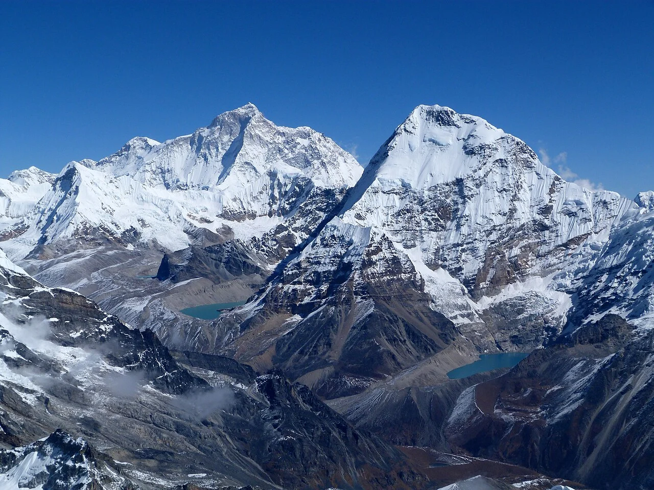
Ridge Anatomy and Survey Figures
Chamlang's defining physical character is its extended ridge system, which runs between multiple intermediate tops and the main west summit. The two survey values in circulation — 7,319 metres from the Nepal Department of Tourism and 7,321 metres from the Himalayan Database, where the peak carries the identifier CHAM — differ by only two metres, and both are explicitly tied to the main west summit rather than to any of the ridge's intermediate features.
The Nepal Department of Tourism records the main summit at 7,319 metres; the Himalayan Database records the same point at 7,321 metres under the identifier CHAM.
The 1962 First Ascent via the South Ridge
The first ascent of Chamlang's main summit was accomplished on 31 May 1962 by So Anma and Pasang Phutar Sherpa, members of a Japanese expedition led by Seiki Nakano of Hokkaido University. The team approached the mountain through the Hongu valley and established their route on the south ridge — a line documented in Nakano's expedition report published in the Himalayan Journal, which includes a first-person account of the approach terrain and upper ridge conditions.
That account stands as the primary contemporary record of the climb. The Hongu valley approach places the mountain in the inner Himalaya, and the south ridge provided the expedition a logical line to the highest point on the long summit crest.
The UFO Line on the Northwest Face
Nearly six decades after the first ascent, Zdeněk Hák and Marek Holeček completed what their reporting describes as the first complete route on Chamlang's northwest face. The pair worked on the face between 17 and 23 May 2019, reaching the summit on 21 May. Their route, which they named the UFO Line, represents a new line on a face aspect that had not previously been climbed in full. Accounts of the ascent were published in the American Alpine Journal.
The name UFO Line carries a deliberate historical reference: in 1981 a separate party had climbed the northern side of the mountain but reached only an intermediate top on the ridge, not the main summit. Hák and Holeček's choice of name acknowledged that earlier effort while marking the distinction between a partial ascent to an intervening high point and their own completion of a continuous line to the principal summit. The 2021 American Alpine Journal also documented the north face and surveyed earlier attempts on that aspect of the peak, situating the 2019 route within the longer arc of Chamlang's climbing history.
Position in the Mahalangur Himal
Chamlang sits within the Mahalangur Himal, the same sub-range that contains Everest, Lhotse, Makalu, and Cho Oyu. Its position above the Hongu valley has shaped the approach used by expeditions documented in sources including Nepal's Department of Tourism facts and figures series.
The ridge complexity and the discrepancy between published summit elevations — 7,319 metres from the Nepal Department of Tourism and 7,321 metres from the Himalayan Database — give Chamlang a distinctive profile among Himalayan sevens. Face-route history includes a 2019 line and, documented in the 2021 American Alpine Journal, A l'Ombre du Mensonge on the north face, which that report compares with the 2019 route.