
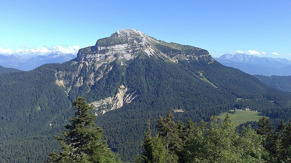
Subalpine limestone geology
The Chartreuse massif is a forested subalpine limestone massif, and Chamechaude encapsulates its architecture on its own. Its summit is distinguished by cliffs of pale, almost white limestone that contrast with the dense forests of its lower flanks. This vertical succession — from the forested valley to the rocky walls — is characteristic of pre-Alpine relief shaped by the differential erosion of the Jurassic and Cretaceous limestone strata found throughout the Chartreuse.
From the Forêt de Grande Chartreuse, the ridge of Chamechaude emerges distinctly above the cover of beech and fir. The neighbouring summits, Grand Som and Dent de Crolles, frame Chamechaude in a panorama that encapsulates the topography of the massif: elongated ridges separated by deep forested combes, all set within the natural divide between Isère and Savoie.
Open terrain and high-altitude pastures
Beyond the wooded zones, the upper slopes of Chamechaude open onto high-altitude grasslands and pastures. These upland grazings form a transition between the subalpine forest and the limestone walls at the summit, and bear witness to an ancient pastoral use of the Chartreuse heights. Chartreuse Tourisme mentions a circuit route around the summit that crosses these open spaces, illustrating how ridgelines and grassy terraces structure movement at this altitude.
The summit in the context of the Parc naturel régional
The Parc naturel régional de Chartreuse identifies Chamechaude as the apex of its territory in its reference diagnostic report. This status as the highest point lends the summit a symbolic value within the park, whose area covers a remarkable altitudinal continuum from the low river valleys to the bare rock slabs above 2,000 m. The position of the massif, straddling two departments and at the junction of the northern Pre-Alps, also gives it a geographical prominence that extends beyond its purely local context.