
Relief and geological substrate
The 2022 report of the Mano River Union (pages 88–89) describes the middle Cavally basin as a series of rocky thresholds and low plains ranging between approximately 100 and 400 metres, distinct from the coastal sedimentary fringe that drops below 20 metres. The bedrock consists of Precambrian crystalline rocks. In the Ivorian–Liberian portion of the middle basin, the report notes predominantly acrisols and latosols with red or yellow hues and a high iron content.
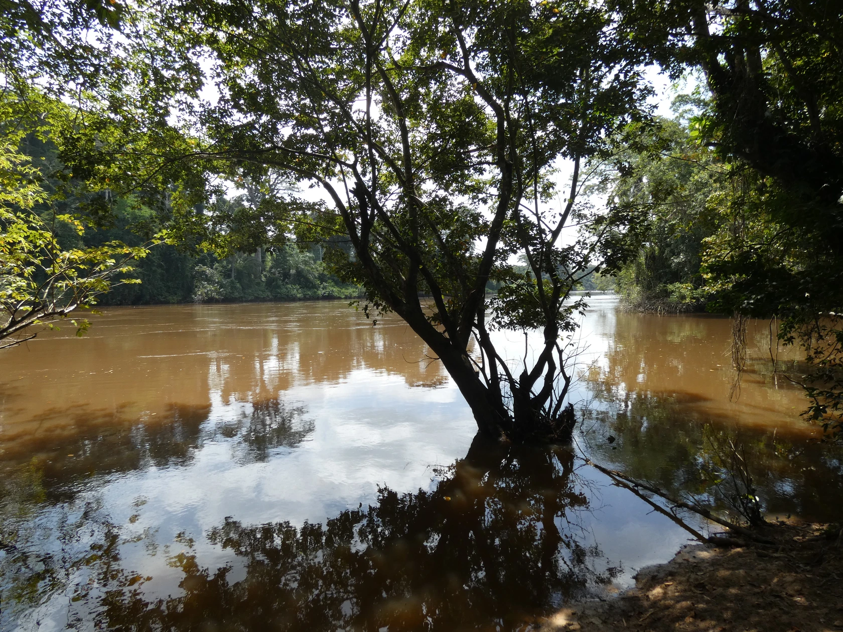
The Cavally itself forms the international border along this entire stretch. The photograph taken on 25 October 2017 from the Ivorian bank near Taï shows the river's forested banks, with Liberia visible on the opposite shore.
Forest protection layers, 1926–2023
Institutional protection of this area developed in several distinct stages. A refuge park for the Middle and Lower Cavally forest region was established as early as 1926 under colonial administration; this was an administrative precursor to Taï National Park, which was established in 1972, designated a biosphere reserve in 1978, and inscribed on the UNESCO World Heritage List in 1982. The Ivorian Office of Parks and Reserves (OIPR) places the town of Taï between the western boundary of this national park and the river. In addition, the Cavaly Classified Forest was the subject of its own classification order under Decree No. 2949/SE/F of 15 April 1954, a process distinct from the history of the national park.
On 13 September 2023, Decree 2023-731 established the Cavally Nature Reserve, covering 66,453 hectares, in the Taï and Zagné area. The OIPR notes the presence of hills exceeding 320 metres within this reserve.
Riparian habitats and fauna
The riparian forests of the Cavally include stands of Uapaca heudelotii, a tree species characteristic of the humid forests of West Africa. The pygmy hippopotamus is among the species recorded in the Cavally Nature Reserve established in 2023.
The assessment conducted by the Mano River Union and the IUCN treats the Sapo–Grebo–Taï complex as an interconnected transboundary landscape relevant to joint restoration strategies; it describes in particular the Grebo and Taï forest massifs within the Cavally watershed.