
Sandstone Ridges and Coastal Landforms
The underlying structure of the Catlins hills derives from the Murihiku Syncline, a large-scale fold in sedimentary layers. The Department of Conservation dates the folding of its sandstone hills to about 150 million years ago. The resulting ridges and valleys run consistently northwest to southeast, giving the landscape its pronounced grain and directing the drainage of catchments such as the Maclennan and Tautuku rivers. The major upland blocks are named the Maclennan and Beresford Ranges in the 1998 Otago Conservation Management Strategy, while the 2016 strategy — incorporating a 2022 partial review — identifies the Tautuku and Maclennan catchments as the core of the Conservation Park.
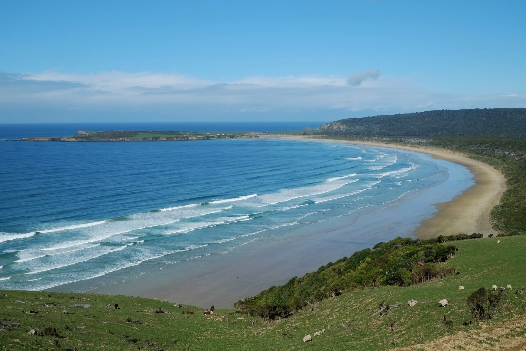
Where the ranges meet the shoreline, the character of the land shifts. At Tautuku, dunes and back-dune forest create a distinct vegetation sequence quite different from the steeper inland slopes. Florence Hill, a prominently situated viewpoint within this coastal zone, looks out across Tautuku Bay and its arc of forested hills — the perspective captured in the guide's header photograph, taken on 9 October 2013.
Forest Cover and Ecological Areas
Silver beech and kāmahi form the dominant canopy across much of the hill country, with rimu present in the richer lowland and gully forest. The 2016 Otago Conservation Management Strategy lists Tautuku, Ajax and Craig Rankin as three ecological areas within the park. The Catlins River forests support populations of mohua (yellowhead), a small native songbird.
Māori Settlement, Milling, and the Coming of the Railway
Māori established seasonal kāika (encampments) along the Catlins coast, including at Papatowai. The Department of Conservation's public programme notes that fish became an increasingly important resource in the diet around 1350. Tautuku was among the coastal sites associated with whaling in the nineteenth century.
European economic activity accelerated sharply after 1879, when a railway began extending southward from Balclutha; it reached Ōwaka in 1896 and pushed on to Tahakopa in 1915. Sawmills followed the rail head into the forest, and farms were established on the cleared land. Ōwaka subsequently developed as a service centre, eventually orienting toward farming and tourism. The Florence Hill lookout received its first interpretive panels in 2012; a later project, funded in part by the Otago Community Trust, produced bilingual replacement panels incorporating Māori place names and wildlife names to describe the landscape seen from the lookout.