
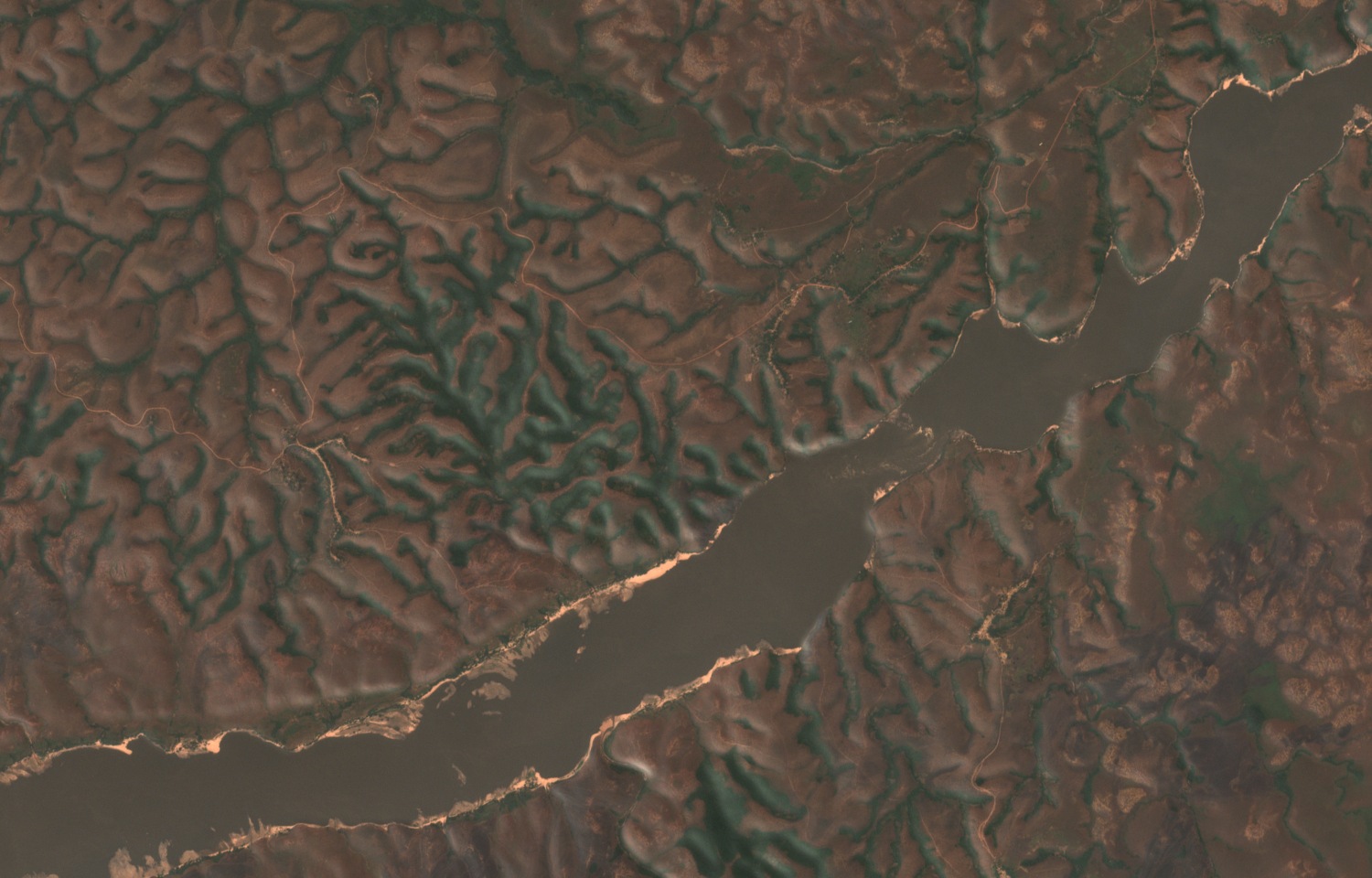
Plateau Surface and Rock Formations
The plateau presents a broad, undulating upper surface interrupted by incised tributary valleys that deepen sharply toward the main river. In his 1961 regional geographic study of the Luozi area, H. Nicolai described the uplands as composed of sandstone, quartzite, and shale corresponding to the Mpioka and Inkisi geological series, with the plateau edge broken into projecting ridges and recesses. Jules Cornet's 1897 ground survey recorded reddish, feldspar-rich sandstone and deeply wooded ravines along a transect between Kendelo and the Inkisi River, where hilltops that appear level from a distance are separated by incised drainage.
The plateau surface represents an older erosional land surface that was subsequently reworked, according to a regional soil and terrain inventory preserved in the Wageningen University repository. Meandering streams occupy the flatter interior areas, while tributaries approaching the main rivers descend abruptly over falls or rapids as they enter hanging valleys cut well below the upland.
The Lower Congo Gorge at Mpioka
From Malebo Pool downstream to Manyanga, the Congo River runs through a canyon, with tributaries reaching it from hanging valleys above. The terrain inventory reports a height difference of up to 480 metres between the plateau surface and the river at Kendelo. Nicolai's 1961 fieldwork documented little floodplain at the Dandanga–Mpioka reach.
A Sentinel-2 natural-colour satellite image acquired on 23 July 2024 shows ridges and short branching tributary ravines converging on the Lower Congo near Mpioka. The gorge and the upland surface are clearly distinct landforms, and the canyon is flanked by the dissected plateau margin.
Kongo Kingdom Provincial Geography
The Lower Congo cataracts region has long been associated with the territorial organisation of the Kongo Kingdom, though locating specific historic sites within the landscape remains a matter of ongoing research. Duarte Lopes was a Portuguese merchant whose account was published in 1591 by Filippo Pigafetta. That account placed the Kongo provincial capital of Mbanza Nsundi roughly a day's travel south of an unidentified set of falls. Later studies considered both the Congo and the Inkisi, where several waterfalls occur, as possible locations, and no account securely identifies which waterfall the description refers to.
Fieldwork conducted in 2012 and 2013 by Clist and colleagues at the site of Kindoki, in the Lower Congo cataracts region, linked Kindoki through historical geography comparisons and archaeological evidence to Mbanza Nsundi, the provincial seat of Nsundi. Their findings, published in 2015, drew on both documentary sources and material evidence recovered from the region. The researchers noted ambiguities in aligning historical accounts with specific landscape features, and historical descriptions of the falls associated with Nsundi do not securely identify any particular waterfall.