
Landform and Structural Setting
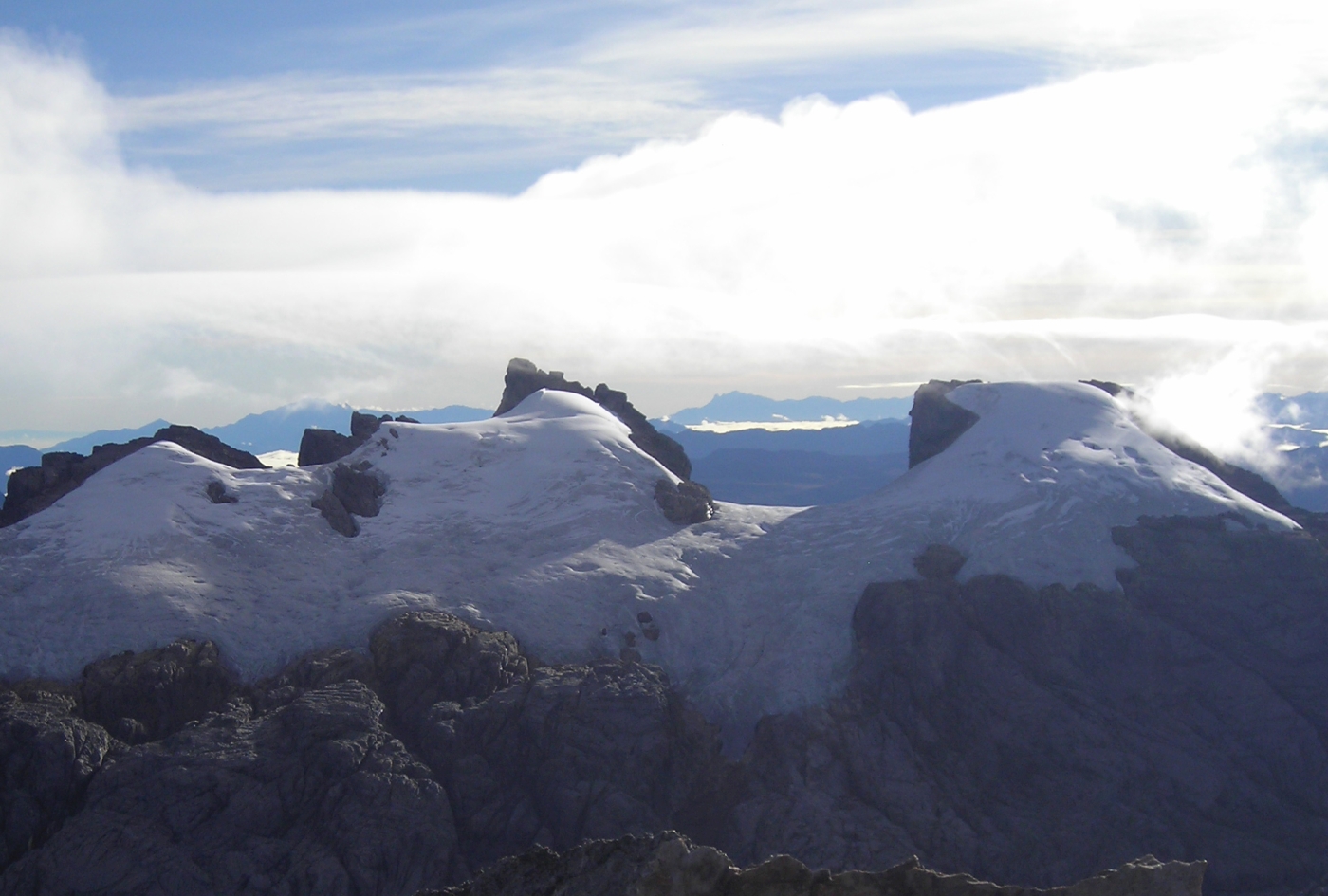
Based on the published Carstensz Glaciers Expedition field account of 1976, the high plateau-like limestone feature stands above roughly 4,400 metres and owes its form to an anticline folded near the edge of a larger syncline. The twin summits sit on the high northern rim of this structure, looking south across a glaciated basin toward the rocky mass of Carstensz Pyramid on the far side.
Glaciers occupying the inner southern side of the ridge, most notably the East Northwall Firn, face toward the Meren valley. A 2007 photograph taken from the summit of Carstensz Pyramid by Christian Stangl shows Sumantri at centre and the table-shaped Ngga Pulu to the right, with the previous broad firn field spread below both peaks.
The 1936 Dutch Expedition and Ngga Poeloe
Anton Colijn, geologist Jean Jacques Dozy, and pilot Frits Wissel reached the snow summit they called Ngga Poeloe on 5 December 1936. Colijn's firsthand account in the Alpine Journal records that the ascent began by moonlight, that clouds began to close in after the party reached the summit, and that they took bearings and panoramic photographs before the view became obscured. Colijn reported an elevation of 5,040 metres derived from a temperature and altitude barometer reading, a figure that belongs to his 1937 expedition report and not to any modern survey.
Dozy's geological field sketch places Ngga Poeloe and East Carstensz at distinct positions on the massif, and the 1936 expedition reported the location under the name Ngga Poeloe. Reading the aerial sketch, the two sites can be followed as separate features, though the shifting of surveyed and climbing names between the 1930s and later expeditions leaves the precise modern equivalent of that reported name open.
The 1964 Japan–Indonesia Expedition and the Name Sukarno Peak
The sketch on page 206 of the Japan Alpine Club journal Sangaku 59 places the label Sukarno Peak and the figure 5,030 metres alongside a pair of summit symbols on the north wall, with Pyramid Peak marked separately across the glaciated valley. The eyewitness account on page 210 records that six climbers reached the western of the two summits at 2:40 p.m. on 1 March 1964 and from there observed the eastern, table-shaped summit across the gap. The Kyoto University Research Resource Archive confirms the party as three Japanese and three Indonesian climbers.
The name Sukarno Peak, or Puncak Sukarno, appears in the historical record with variable reference. An Australian expedition glossary lists Pk. Sukarno under both the broader Mt. Jaya and Ngga Pulu, illustrating that the historical spelling cannot be assigned universally to a single geographic point on the ridge.
Mapped Elevations and Ice Change
The U.S. Geological Survey reproduced the Australian expeditions' 1:20,000 map, on which Ngga Pulu is labelled 4,862 metres on the northeast side of the former Meren Glacier. The 2025 Cryosphere overview base map separately labels Sumantri at 4,870 metres.
Ibel, Mölg and Sommer combined historical mapping with modern satellite imagery to measure the East Northwall Firn across three defined ice areas, recording a total of approximately 348,856 square metres in 2018 falling to 120,812 square metres in 2024. By comparing aerial photographs from the 1936 and 1972 expeditions they demonstrated that the formerly continuous Northwall Firn had divided into western and eastern portions by 1972. The Stangl photograph of 9 April 2007 shows the eastern firn field as it appeared from across the southern basin at an earlier stage of that retreat.