
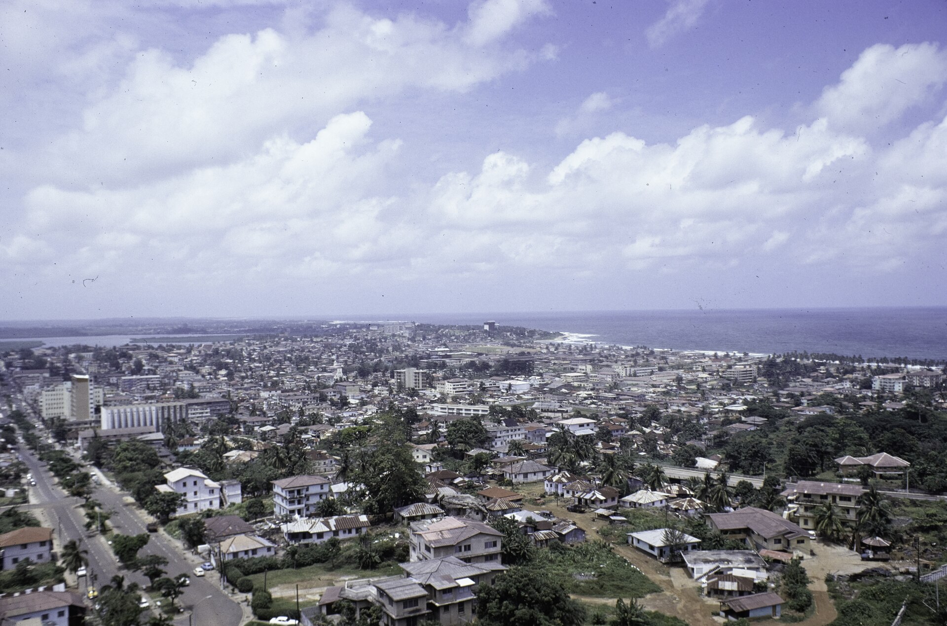
Geology of the Headland
The Liberia Ministry of Public Works physiographic assessment attributes the elevated ground of central Monrovia, including Cape Mesurado itself, to diabase dikes. These sheets of hard rock formed when magma entered fractures and cooled. River and beach sands make up much of the lower ground around nearby Paynesville.
In the 1975 photograph taken from the Ducor Hotel, Broad Street appears at left. The wetlands stretch behind it, while the Atlantic fills the right side of the horizon.
The Cape on Early Maps of Monrovia
Local communities lived along the coast before the arrival of the American Colonization Society. An 1821 map in the Library of Congress shows where the society planned a town at Mesurado. In 1821, ACS representatives negotiated, and in some accounts coerced, the transfer of land from local leaders. The following year, survivors of an earlier failed settlement at Sherbro Island arrived at Cape Mesurado and established a settlement with ACS support, comprising free-born and formerly enslaved people from the United States. The place was initially known as Christopolis before being renamed Monrovia in honor of President James Monroe during the 1820s.
Liberia declared independence in 1847, and Monrovia became the capital of the republic.
The Mesurado Wetlands
Behind the headland, the landward side of the cape gives way to the wetland system visible in van der Kraaij's 1975 photograph. The Mesurado Wetlands were designated Ramsar site 1631 on 24 August 2006, covering 6,760 hectares and recognized notably for their mangrove cover. The mangroves grow in brackish water where tidal and river waters meet.
Climate Resilience and the Urban Edge
The government of Liberia and partners launched the Monrovia Metropolitan Climate Resilience Project in 2021, with stated goals that included restoration of mangrove cover and targeted attention to low-lying neighborhoods. The project also addresses coastal flooding and erosion in neighborhoods such as West Point, where the low ground lies close to the Atlantic.