
Horst Structure and Geomorphological Origins
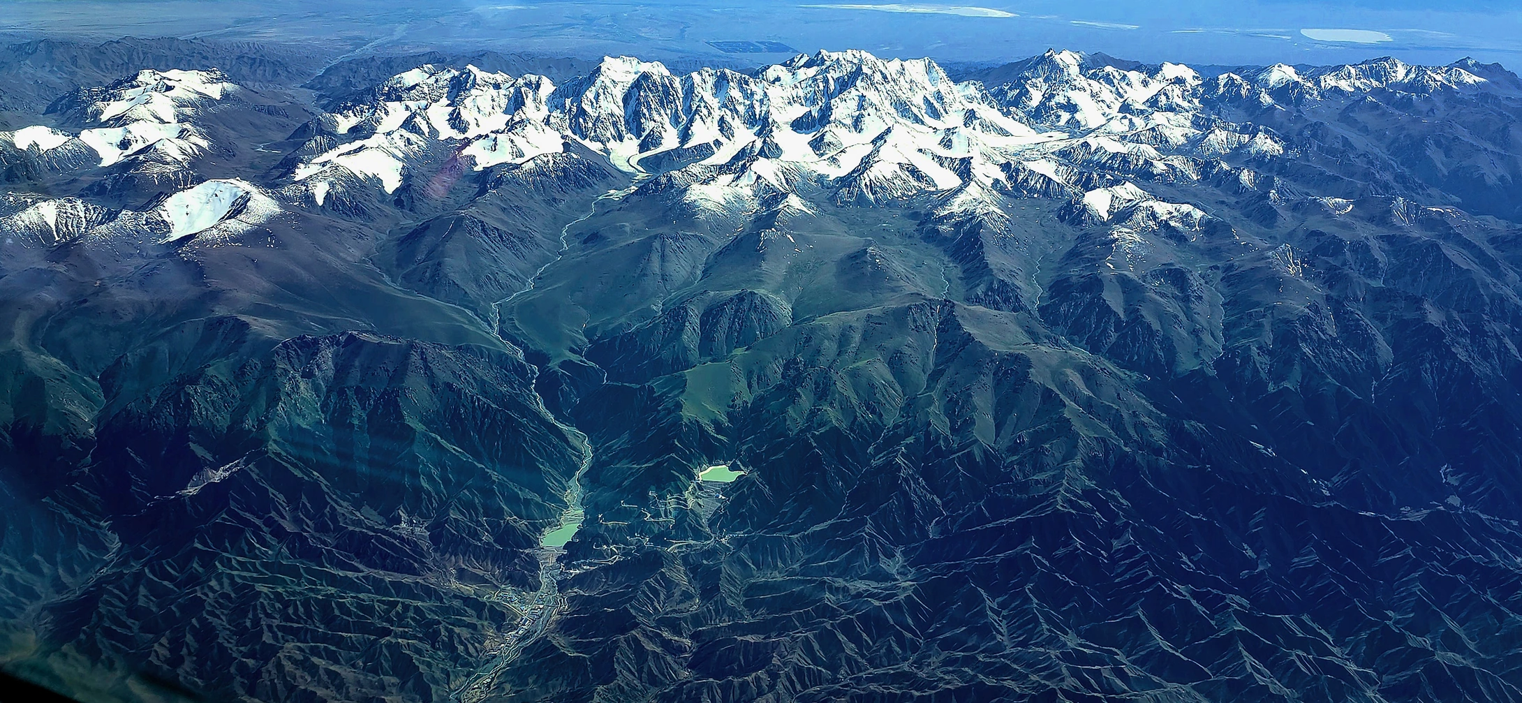
Geological data from natural resources authorities explicitly characterise the Bogda massif as a classic horst structure. A horst is a fault-bounded block in which the central mass has been uplifted relative to the terrain on either side; this tectonic setting gives Bogda Peak its sharply prominent profile above the surrounding landscape, with steep ridgelines and pronounced slope relief. This structural character is consistent with the differential-uplift orogenic geomorphology found across much of western China, yet within the Eastern Tian Shan, Bogda Peak stands as the most representative high point of this tectonic unit at 5,445 m.
It is worth noting that tectonic uplift and glacial sculpting are geomorphologically independent processes operating on separate timescales. The formation of the horst corresponds to tectonic movements spanning millions of years or longer, while modern glacier activity has continued through more recent geological periods and under present-day climatic conditions. It is precisely this superimposition — the tectonic forces first establishing the structural framework of the mountain, then glacial forces refining its detail — that has created Bogda Peak's composite landscape character, combining the broad structural ridgelines of tectonics with the intimate glacially eroded landforms of the summit zone.
Modern Glaciers: A Continuously Evolving Alpine System
Bogda Peak hosts modern glaciers, making it particularly remarkable in the arid Eastern Tian Shan. The presence of modern glaciers means that the mountain's high-altitude zone still maintains a stable supply of snow and ice, and glacial processes continue to modify surface morphology in real time. Meltwater from glacial ablation forms an important component of the mountain's hydrological system, draining downslope into the piedmont zone and ultimately linking with surrounding water bodies.
The characteristic landforms of glacial erosion — cirques, arêtes, and moraine ridges — typically leave clear imprints on mountains subjected to prolonged glacial action. As a high peak with active modern glaciers, the summit zone of Bogda Peak offers an important window for understanding the alpine natural systems of the Eastern Tian Shan. The dynamic behaviour of its glaciers also makes Bogda Peak a natural reference point for observing regional climate and cryosphere responses.
Bogda Peak and Tianchi Lake: Distinct Geographic Units within a Single Natural Area
Documentation from the Xinjiang government and the Department of Natural Resources explicitly states that Bogda Snow Peak and Tianchi Lake at its foot belong to the same natural area, but are not the same place. This distinction has substantive significance for geographic description: Bogda Peak is the high point of the mountain system, while Tianchi is an alpine lake in the piedmont zone; the two differ markedly in elevation, landform type, and ecological environment. Only by treating them as mutually independent yet naturally and geographically interrelated units can the spatial structure of this area be accurately understood.
Within the broader heritage geographic framework, the area containing Bogda Peak forms one of the component zones of the Tianshan World Heritage Site. The Tianshan World Heritage Site spans multiple countries and was inscribed for its outstanding mountain ecosystems and geomorphological diversity. The Bogda component zone represents, within this system, the characteristic tectonic and glacial landforms of the Eastern Tian Shan, together with the associated mountain water landscapes — summit glaciers, piedmont lakes, and fault-block ridges — which together constitute the natural narrative of this heritage area.
Geographic Coordinates of the Eastern Tian Shan
Bogda Peak is located in the Eastern Tian Shan of the Xinjiang Uyghur Autonomous Region. At 5,445 m it is the highest point of this segment of the range. The Eastern Tian Shan forms the eastward-tapering tail of the broader Tian Shan system; while somewhat lower than the western sections overall, Bogda Peak still stands distinctly above the regional terrain by virtue of its structural uplift. Viewed within the macro-scale landform geography of China, the Eastern Tian Shan belongs to the inland mountain systems of the west, and the arid to semi-arid climatic context makes the development of modern glaciers on Bogda Peak all the more exceptional — endowing this summit with an irreplaceable emblematic status in regional physical geography.