
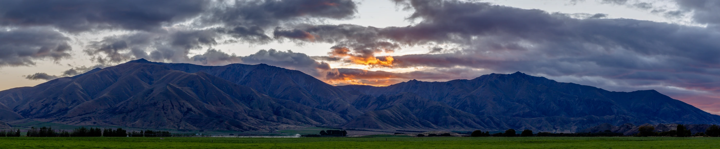
Landform and Summit Vegetation
The Waitaki District Council describes the range as a block raised along faults. Streams cut valleys through its flanks, running out into the basin flats. In Michal Klajban’s photograph, cultivated fields spread out beneath dry, sharply cut ridges.
On the summit ridge, narrow-leaved snow tussock (Chionochloa rigida) and slim snow tussock (Chionochloa macra) grow among scattered alpine herbs. The Department of Conservation records them in extensive fellfields, open ground where plants grow in patches among gravel and rock.
High-Country Pastoral History
Benmore Peak is marked on a map of former station boundaries in the Department of Conservation’s history of high-country farming. By 1976 the old Benmore Station and the Otago portion of Lake Ōhau Station had been split into smaller holdings, including Totara Peak, Glenbrook and Ben Omar.
The Waitaki and Te Ao Mārama
Construction of the Benmore hydroelectric project began in 1958. The power station opened in 1965, the year the high-voltage direct-current link from Benmore to Haywards was completed. The dam held back the Waitaki River, creating the lake that now meets the range’s southeastern slopes.
The Ngāi Tahu Claims Settlement Act 1998 records the significance of Te Ao Mārama to Ngāi Tahu. The reservoir covers a stretch of the Waitaki, which carries water from Aoraki and the high-country lakes to the sea. The statutory account records the name Wai-para-hoanga for water that once flowed unobstructed from those lakes.