
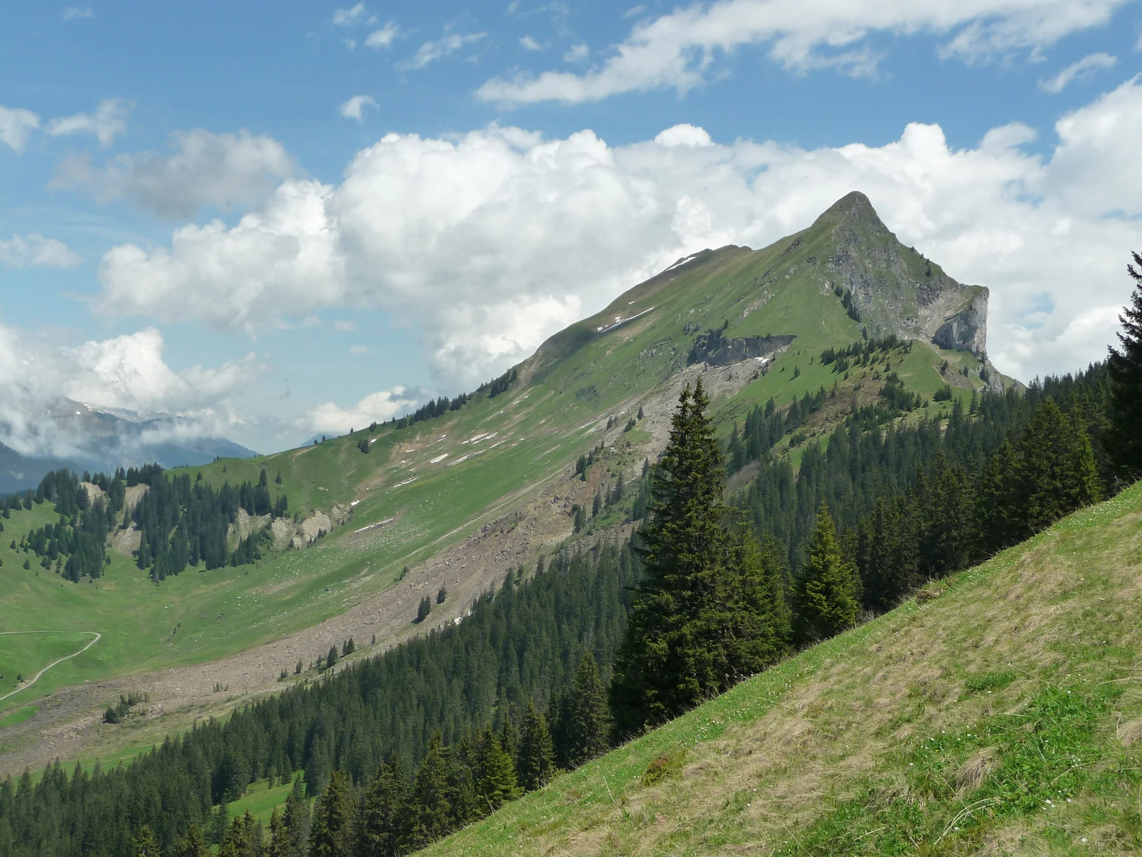
Two ridges around Habkern
In the Canton of Bern's forest plan 2008–2022, the Harder–Augstmatthorn ridge forms the eastern boundary of the planning area around Habkern. To the west lies the Niederhorn–Hohgant ridge. Both ridges consist of rocks from the Wildhorn Nappe dating to the Cretaceous and Tertiary periods, primarily hard limestone and Hohgant sandstone. Between them lies the Habkern basin, which formed in flysch rocks.
From alp to summit
In 1984, Paul Zinsli records in Gipfelnamen in den Schweizer Alpen a document from 1377 in which a pasture near Habkern is referred to as Ougstmatten — preserved as such in the Fontes rerum Bernensium. Zinsli uses the Augstmatthorn in his study as an example of name migration: a local field name originally associated with a familiar and used piece of pastureland gradually shifted upward over time and became attached to the summit above it.
The local chronicle of Habkern lists the name of the alp Augstmatte and that of the summit Augstmatthorn as separate entries. The document of 1377 attests the name of the alp.
The return of the ibex
On 21 June 1921, seven Alpine ibex were released at Wanniknubel in the Harder area — three males and four females. According to the Bernese hunting inspectorate, further releases followed. In 1924, one male and two females were set free on the southern slope of the Augstmatthorn.
The Swiss Alpine Club reported in 1950 a population of 160 animals for the year 1949 in the colony at the Augstmatthorn. The Federal Office for the Environment lists the area as Federal Game Reserve No. 1.
The debris flow from the Suggiture
In early June 2013, a debris flow of rock and mud descended from the neighbouring Suggiture as far as the Bodmi alp. The material buried the bed of the Bodmibach and destroyed two bridges. The Jungfrau Zeitung reported on 20 June on the joint situation assessment by the municipalities of Habkern and Unterseen along with other parties involved.
On 15 June 2013, Johnny.m76 photographed the ridge from the southwest. To the right of the Augstmatthorn stands the Suggiture. On its flank the wide, bare track along which mud and rock reached the valley is clearly visible.