
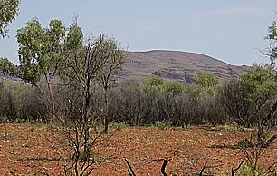
Anmatyerr Country and Living Connections
Apmakwenge lies on Anmatyerr Country. The area around Ti Tree includes the Anmatyerr-speaking communities of Pmara Jutunta, Nturiya and Wilora. The Central Desert Regional Council documents the longstanding role of Anmatyerr stockmen and stockwomen along the old north–south stock route and on pastoral leases in the area.
The botanical record provides one measure of the mountain's ecological distinctiveness within the region. A Northern Territory government survey of sites of botanical significance covers the mountain and its neighbouring hills as site 21-3-2 on the Burt Plain, noting that nearby hills and lowland areas receive runoff and support lithologies distinct from the summit formation. The survey maps mulga shrubland, spinifex grassland and low woodland across the surrounding country.
Terminal Ediacaran Geology: The Central Mount Stuart Formation
The Northern Territory Geological Survey records a named stratigraphic unit — the Central Mount Stuart Formation — exposed on the southern flank of the mountain, documented in figure 28.11 of the Georgina Basin synthesis. The formation consists of red-brown sandstone with interbedded mudstone and accumulated in the southern Georgina Basin. Government synthesis of the sedimentary evidence interprets the deposits as water-laid channel and alluvial sediments, with some more distal material interpreted as shore or shallow-marine delta facies.
The formation is assigned a terminal Ediacaran age, placing its accumulation near the beginning of the Petermann Orogeny, the 580–530 Ma mountain-building episode that shaped much of central Australia's deep structure. The survey dated the sedimentary formation using fossil evidence and its relationship to adjacent strata.
Stuart's 1860 Ascent and the Question of a Centre
John McDouall Stuart's published journal records that on 22 April 1860, the expedition took a position south-southwest of the mountain and established it as the approximate centre of the continent by solar observation. The following day, 23 April 1860, Stuart and William Kekwick ascended the mountain, raised a British flag, and built a stone cairn containing a signed note in a bottle. Benjamin Head, the third member of the expedition, also signed the note. Stuart originally chose Central Mount Sturt to honour his former expedition leader Charles Sturt. In his diary of the 1860–61 expedition he used Central Mount Stuart, a name that had been changed in his honour. The Northern Territory Place Names Register holds the historical name Central Mount Sturt separately as entry 11669.
Modern calculations yield different centres depending on the method. The points Geoscience Australia lists for the mainland lie farther south. Stuart’s 1862 return journey from Adelaide to the Arafura Sea revived the proposal for an overland telegraph. In 1872 the line linked Port Augusta with Darwin, following much of his route. A roadside cairn was installed in 1960 to mark the centenary of the 1860 naming; the site became Central Mount Stuart Historical Reserve, with an official name change recorded in 1979 and a declaration recorded in 2002.
Type Specimens: Two Species Anchored to This Country
A type specimen is the single physical collection that formally anchors a species name in botanical nomenclature. Stuart collected material that is probably the type of Hakea grammatophylla in the mountain and adjacent country around 1861–62, in the vicinity of Forsters Range; the published type locality is recorded as "Scrub near Forsters range, Central Mount Stuart." Ferdinand von Mueller first described the species under Grevillea in 1865 and moved it to Hakea in 1868.
Nearly a century later, on 2 July 1974, botanist Peter K. Latz collected the type specimen of the spinifex grass Triodia triaristata within the same site. M. Lazarides formally described the species in 1997, with Latz's 1974 collection as the name-bearing type. The species records link the plant names to two collections from the mountain and neighbouring country, made more than a century apart.