
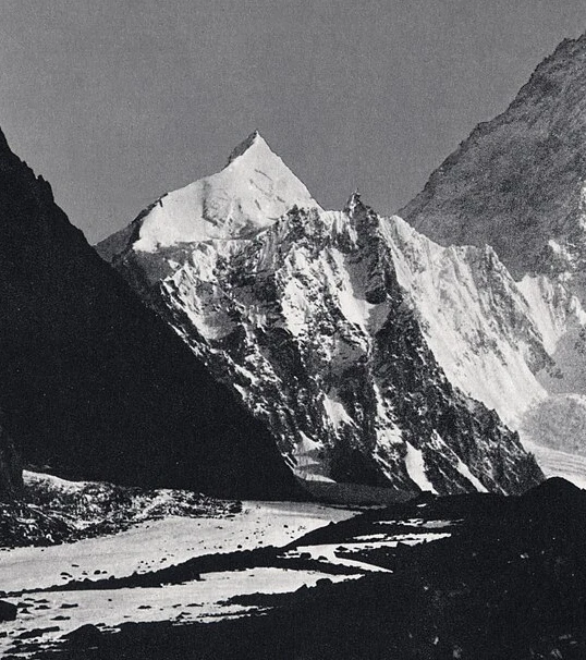
Names, Elevations, and Cartographic Identity
The Central Karakoram National Park lists the mountain as Angel Peak at 6858 metres, and its annotated guidebook map identifies the same feature as Angelus Peak on the spur southwest of K2, near Negrotto La. These two names refer to the same summit. Survey figures show some scatter across sources: the 1983 Polish Alpine Association Taternik expedition map gives 6855 metres, while the 1984 American Alpine Journal report gives 6885 metres.
A 1979 American Alpine Journal account of K2 exploration locates Negrotto Saddle as the col lying between K2 and Angelus during investigation of the proposed Magic Line route, providing a geographical anchor for Angel Sar's position on that southwest spur.
First Ascent, 1983
Michel Afanassieff and Claude Stucki reached the summit on August 9, 1983, having climbed the southwest face before gaining the south-southwest ridge to the top, as recorded in the American Alpine Journal.
The AAC record notes that the August 1983 party established a base camp at approximately 16,400 feet before ascending the face. The descent bivouac at 19,700 feet is the last elevation figure in the documented account of that climb.
Visual Record and Geological Character
Vittorio Sella's 1909 expedition photographs of the K2 massif include an image in which Angel Sar appears as a distinct snowy pyramid, annotated as such in the original and identifiable as a feature separate from the higher summit of K2. Geological field notes published in the Himalayan Journal describe the Angelus ridge as part of the broader K2 massif structure.
Park Context
The Central Karakoram National Park's official high-summit list places Angel Sar at 6858 metres, and the park's annotated guidebook map locates the mountain on the southwest side of K2. This pairing of list entry and cartographic annotation connects the name Angel Peak used in park documentation with the position identified as Angelus Peak on the guidebook map, confirming they refer to the same feature — a relationship consistent with the Taternik expedition cartography and the AAJ geographical description.