
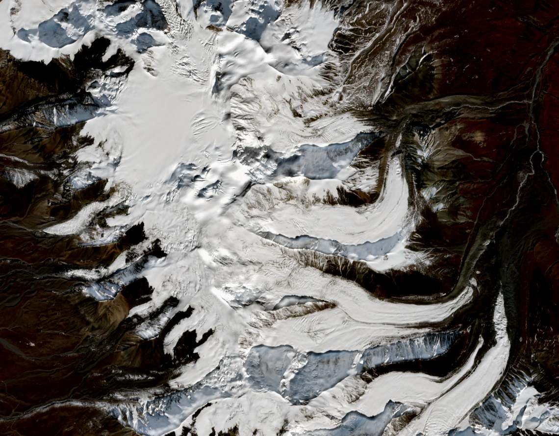
Where the East Ridge Meets the Crest
From the glacier-covered east side, an east-facing spur climbs toward the East Summit, then the crest continues southwest to higher Maqen Gangri. Town's map identifies this rise above the Harlon II Glacier basin. A Copernicus GLO-30 surface model suggests a shallow dip of only about 5 m between the East Summit's crest and higher terrain to the southwest, illustrating how closely it remains connected to the main ridge.
The 6,090 m Amne Machin III lies farther south-southeast along the mountain chain, beyond Harlon II Glacier. Town distinguished the ridge running east from the East Summit from the main northeast ridge extending over several lower points.
Two Expeditions on the Eastern Flanks in 1981
On 9 June 1981, Harold Knutson, Galen Rowell and Kim Schmitz reached the 6,282 m main summit, with Rowell describing the overall line as the northeast ridge. Town's map and subsequent article place their line on the east ridge of the subsidiary East Summit before the main crest.
In September 1981, Lincoln Hall, Geof Bartram, Tim Macartney-Snape and Andrew Henderson climbed the east face to the 6,152 m East Summit, where they crossed into the saddle and dug a snow cave between the summits. Hall and Macartney-Snape reached the higher Maqen Gangri summit on 25 September, while the other two began descending. Hall later described taking the long northeast ridge down because wind and deep snow made the east ridge too dangerous to descend.
Glaciers on the Eastern Side
A 1983 Journal of Glaciology study drawing on the 1981 joint Chinese-German expedition counted 40 glaciers across the study area. It documented 790 m of terminus advance on Halong Glacier in the 15 years from 1966 and identified signs of a surge.
A 2025 study combining field and satellite observations examined the Amne Machin massif in the upper Yellow River basin, mapping ice caps, valley glaciers and hanging glaciers as part of the same glaciated landscape.
The East Summit in Satellite View
In this 10 November 2026 Sentinel-2B image the East Summit appears just above and left of centre, with the main summit lying diagonally below it to the left and eastern glacier tongues winding around the ridges along the right. The image is cropped and colour toned with no annotation. Contains modified Copernicus Sentinel data 2026.